Cape Poge Light
Also known as: Cape Pogue Light

Why it's listed
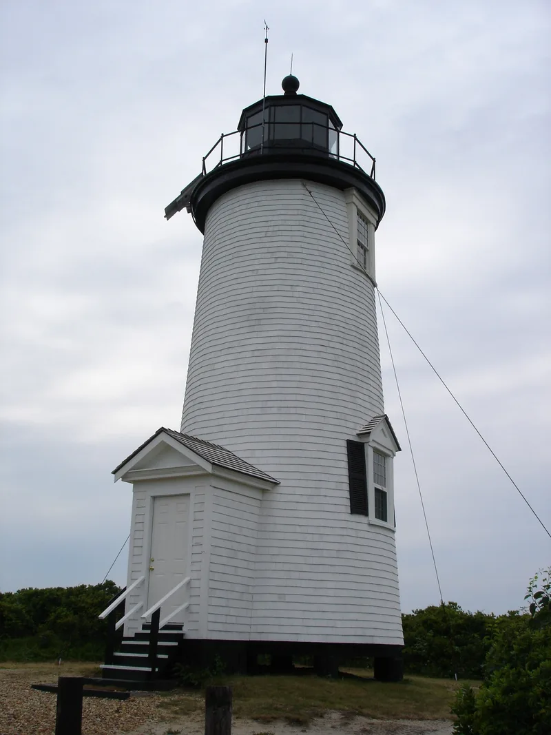
Cape Poge Light is a conical, wood-framed lighthouse on the northeast point of Chappaquiddick Island, off eastern Martha's Vineyard in Edgartown. The shingled tower rises 55 feet above water level on wooden piers, with a small gabled entry porch, a balcony with simple posts and a ten-sided lantern topped by a ball vent and lightning rod. It marks one of New England's easternmost landfalls and the route to Edgartown Harbor. A beacon stood here in the 18th century, and the first tower dates to 1802. Shoreline erosion has repeatedly claimed or forced the movement of the light, and records suggest it was relocated at least six times. The present tower follows 1893 plans for a temporary light and was moved to its current spot in 1922. It was recognized for its retained integrity, its place in the development of Massachusetts navigation aids, and its status as one of only seven wood-frame lighthouses in the state. A further move inland was planned because of erosion.
Significance in brief: The nomination argues the light retains integrity of location, design, setting, materials and workmanship, and is tied to the development of aids to navigation in Massachusetts. It is the third tower on the site, the first having been erected in 1802. It is one of only seven wood-frame lighthouses in the state.
Machine-generated summary. This summary was generated by a language model from the official nomination document and has not been reviewed line by line by an editor. It may contain errors. Check the source document before relying on any detail. Source: nomination document (PDF) · National Archives catalog entry. NRHP reference 87002040, listed September 28, 1987. Summary generated October 2026 (model claude-sonnet-5-5, prompt v1.0-2026-10-29, confidence medium).
Key facts
| Address | Chappaquiddick Island, Edgartown |
|---|---|
| County | Dukes County |
| Listed | September 28, 1987 |
| Reference number | 87002040 |
| Resource type | Structure |
| Architectural style | Conical wood-framed lighthouse tower |
| Criteria |
|
| Areas of significance | Engineering, Transportation, Architecture, Maritime History |
| Level of significance | State |
| Status (as stated in the nomination) | Listed as unmanned and active. The windows are boarded up and the interior has no access. The 1851 keeper's dwelling is described as deteriorated, altered and abandoned and is excluded from the nomination. A relocation of about 500 feet southwest was planned for fall 1986 because of erosion. |
| Acreage | 0.9 |
| Coordinates | 41.42022, -70.45217 (NPS GIS) |
What listing means for this property
National Register listing is honorary: it recognises significance and does not restrict what a private owner may do without federal money or permits. It unlocks the 20% federal rehabilitation tax credit for income-producing buildings, state credits in many states, and Section 106 review when federal agencies are involved. See what listing means in practice.
General information, not legal or tax advice. Rules change; confirm with your State Historic Preservation Office or a qualified adviser.
Sources and further reading
- National Park Service, National Register of Historic Places database (snapshot May 2026), reference 87002040.
- Nomination form (PDF, National Archives) — catalog entry
- Wikipedia article (used for cross-checking only; text not reproduced here)
- Wikidata Q5034997
- This listing as JSON
Last updated October 2026. Found an error? See the editorial policy for how to report it.