Mohawk Trail

Why it's listed
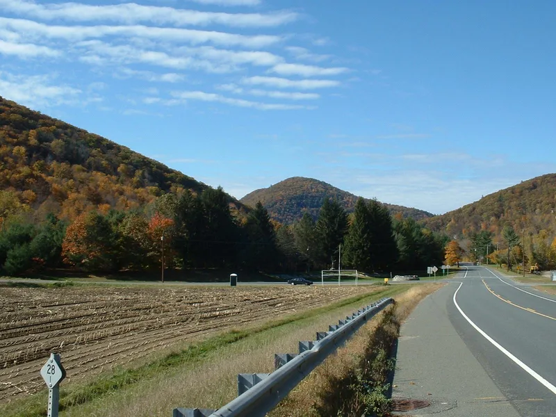
A 3.76-mile stretch of the Mohawk Trail runs east to west along the north bank of the Cold River in Mohawk Trail State Forest, across the towns of Charlemont, Savoy and Florida, Massachusetts. The trail began as an Indian pathway linking the Hudson and Mohawk river valleys in New York with the Deerfield and Connecticut river valleys. Mohawks used it to fish the spring salmon runs, to hunt, and to raid enemies, including the Pecumtucks in 1667. Philip of the Wampanoags travelled it during King Philip's War, and French and Indian forces used it against English settlements. Benedict Arnold rode part of it toward Fort Ticonderoga during the Revolution. Farming in the nineteenth century gave way to forest, the state began buying land in 1920, and Civilian Conservation Corps crews made improvements in the 1930s. The trail itself is no longer visible, but its course is preserved in a wooded setting.
Significance in brief: The trail was an Indian route from the Hudson and Mohawk valleys in New York to the Deerfield and Connecticut valleys. It was used for fishing, hunting and raiding, and by French and Indian forces against English settlements. Though the trail is no longer extant, its course is preserved in a natural, forested setting.
Machine-generated summary. This summary was generated by a language model from the official nomination document and has not been reviewed line by line by an editor. It may contain errors. Check the source document before relying on any detail. Source: nomination document (PDF) · National Archives catalog entry. NRHP reference 73000283, listed April 3, 1973. Summary generated October 2026 (model claude-sonnet-5-5, prompt v1.0-2026-10-29, confidence medium).
Key facts
| Address | Along the bank of the Cold River, Florida and Savoy |
|---|---|
| County | Berkshire County |
| Listed | April 3, 1973 |
| Reference number | 73000283 |
| Resource type | Site |
| Areas of significance | Native American, Transportation |
| Level of significance | State |
| Status (as stated in the nomination) | Condition is marked good; the trail itself is no longer extant, but its course is preserved in a natural setting. The area is maintained by the state for recreation and conservation. |
| Acreage | 2275 |
| Coordinates | 42.63758, -72.95302 (NPS GIS) |
What listing means for this property
Sites (archaeological sites, battlefields, landscapes) are often listed with a restricted address to protect them from looting or disturbance. Listing is honorary for private owners; federal undertakings on or near the site go through Section 106 review, and state laws may protect burials and artefacts regardless of listing.
General information, not legal or tax advice. Rules change; confirm with your State Historic Preservation Office or a qualified adviser.
Sources and further reading
- National Park Service, National Register of Historic Places database (snapshot May 2026), reference 73000283.
- Nomination form (PDF, National Archives) — catalog entry
- Wikipedia article (used for cross-checking only; text not reproduced here)
- Wikidata Q1033241
- This listing as JSON
Last updated October 2026. Found an error? See the editorial policy for how to report it.