Lower Historic District

The pin is a point inside the NPS boundary polygon, not a surveyed location.
Why it's listed
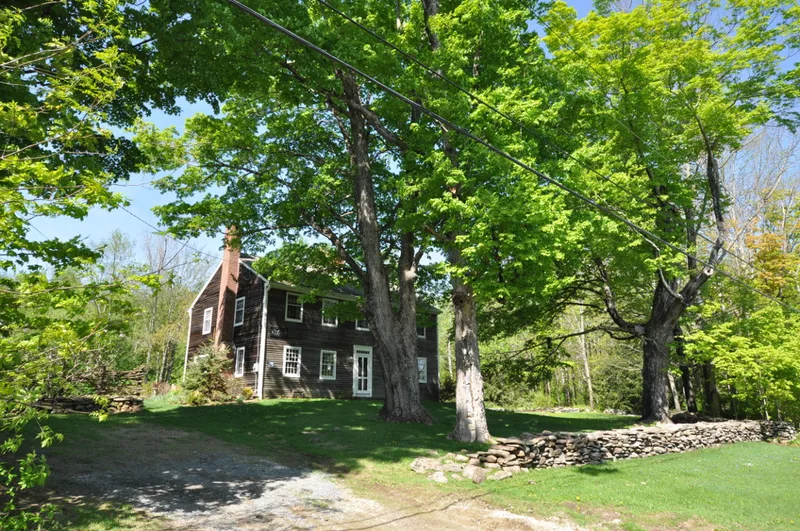
Four farmhouses line Washington Mountain Road on a terrace of the southern slope of Washington Mountain, at about 1,600 feet. They are the surviving core of the earliest residential settlement in Washington, Massachusetts, known as Milliken's Corner. The William Milliken Farm, built soon after a 1763 land grant to one of the town's first ten proprietors, is the only Colonial-period building left in the town. Three Federal-period houses followed by about 1803: the Hiram Savery House, the Richmond-Foster-Corey House and the Clark-Strong-Abbott-Pomeroy House. Farming on the rocky land was difficult and stayed at subsistence level. When the County Road opened in 1830 and a railroad was built later in the century, both east of the mountain, development moved east and the settlement stopped growing. That lack of growth left a modest linear pattern of farms that most hilltowns lost. The district was listed for its local significance in settlement history and early architecture.
Significance in brief: The nomination argues the district is the intact remnant of the town's earliest residential settlement, which followed a linear pattern along the mountain slope. Rugged terrain, poor farmland and isolation kept the village from growing past the mid 19th century, which preserved its early buildings. It includes the only Colonial-period building surviving in the town.
Machine-generated summary. This summary was generated by a language model from the official nomination document and has not been reviewed line by line by an editor. It may contain errors. Check the source document before relying on any detail. Source: nomination document (PDF) · National Archives catalog entry. NRHP reference 86002141, listed September 12, 1986. Summary generated October 2026 (model claude-sonnet-5-5, prompt v1.0-2026-10-29, confidence high).
Key facts
| Address | Washington Mountain Rd., Washington |
|---|---|
| County | Berkshire County |
| Listed | September 12, 1986 |
| Reference number | 86002141 |
| Resource type | District |
| Period of significance | ca. 1765-1803 |
| Architectural style | Georgian and Federal |
| Criteria |
|
| Areas of significance | Agriculture, Exploration/Settlement, Architecture |
| Level of significance | Local |
| Status (as stated in the nomination) | Condition is described as good. Present use is residential and agricultural, and the William Milliken farmhouse has recently been restored. |
| Acreage | 130 |
| Coordinates | 42.34116, -73.11703 (NPS GIS) |
What listing means for this property
This is a historic district. Buildings within its boundary are either contributing (they add to the district's significance) or non-contributing. Owners of contributing income-producing buildings can claim the 20% federal rehabilitation tax credit; homeowners should look at state credits. National Register districts impose no design review by themselves; a local historic district ordinance, if one exists, does (the difference explained).
General information, not legal or tax advice. Rules change; confirm with your State Historic Preservation Office or a qualified adviser.
Sources and further reading
- National Park Service, National Register of Historic Places database (snapshot May 2026), reference 86002141.
- Nomination form (PDF, National Archives) — catalog entry
- Wikipedia article (used for cross-checking only; text not reproduced here)
- Wikidata Q6693526
- This listing as JSON
Last updated October 2026. Found an error? See the editorial policy for how to report it.