Main Street Historic District

Why it's listed
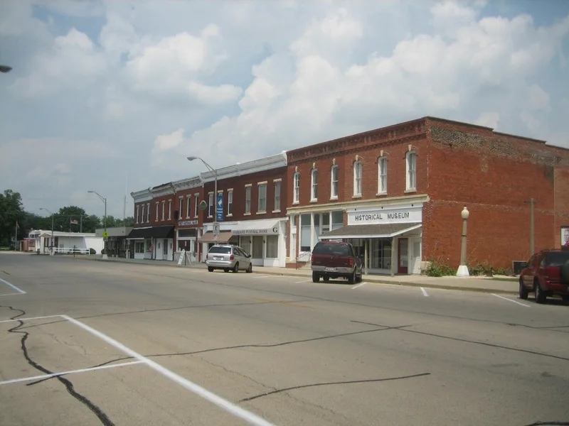
Tampico's Main Street Historic District occupies both sides of the 100 block of South Main Street, the town's traditional business center between Market Street and the railroad tracks. Of its 14 major structures, 10 are classed as significant and three more contribute to its character. Most are two-story brick buildings with uniform setbacks and cornice lines, built after fires and a tornado in the 1870s pushed merchants toward masonry. A building boom followed between 1896 and 1905 as the town served surrounding farms and canal construction workers. The district is also known as the birthplace of Ronald Reagan, who was born on February 6, 1911, in the second-floor apartment at 111 S. Main. His father later clerked at the Pitney variety store at 122-124 S. Main, where the family lived again from 1919 to 1920. A 1970s bank building is the only intrusion, and recent fires have left a vacant lot.
Significance in brief: The district is significant as a relatively intact turn-of-the-century commercial district in a small rural Illinois community. It also contains the birthplace of Ronald Reagan, 40th President of the United States, born at 111 S. Main in 1911. Its architectural value comes from the interrelationship of the buildings, which share uniform setback, height and cornice lines.
Machine-generated summary. This summary was generated by a language model from the official nomination document and has not been reviewed line by line by an editor. It may contain errors. Check the source document before relying on any detail. Source: nomination document (PDF) · National Archives catalog entry. NRHP reference 82002602, listed June 3, 1982. Summary generated October 2026 (model claude-sonnet-5-5, prompt v1.0-2026-10-29, confidence medium).
Key facts
| Address | S. Main St., Tampico |
|---|---|
| County | Whiteside County |
| Listed | June 3, 1982 |
| Reference number | 82002602 |
| Resource type | District |
| Period of significance | 1871-1920 |
| Architect / builder | various |
| Areas of significance | Commerce, Exploration/Settlement, Politics/Government, Architecture |
| Level of significance | National |
| Status (as stated in the nomination) | Land use is strictly commercial, with some second-floor apartments. Several buildings are vacant, and 119 S. Main is deteriorated after a fire. A 1970s bank building is an intrusion. |
| Acreage | 2.3 |
| Coordinates | 41.63336, -89.78344 (NPS GIS) |
What listing means for this property
This is a historic district. Buildings within its boundary are either contributing (they add to the district's significance) or non-contributing. Owners of contributing income-producing buildings can claim the 20% federal rehabilitation tax credit; homeowners should look at state credits. National Register districts impose no design review by themselves; a local historic district ordinance, if one exists, does (the difference explained).
General information, not legal or tax advice. Rules change; confirm with your State Historic Preservation Office or a qualified adviser.
Sources and further reading
- National Park Service, National Register of Historic Places database (snapshot May 2026), reference 82002602.
- Nomination form (PDF, National Archives) — catalog entry
- Wikipedia article (used for cross-checking only; text not reproduced here)
- Wikidata Q1885542
- This listing as JSON
Last updated October 2026. Found an error? See the editorial policy for how to report it.