Emerald Mound and Village Site
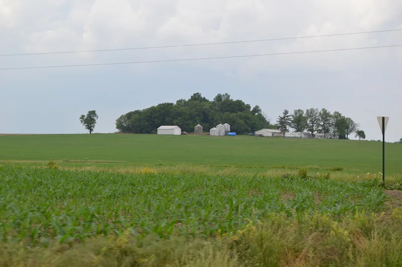

Why it's listed
Emerald Mound and Village Site lies about 3.5 miles northeast of Lebanon, Illinois, and was the principal mound of a Middle Mississippian town tied to the great center at Cahokia. The main mound is roughly 300 feet square at the base, 150 feet square at the top and 50 feet high, with an apron extending over 100 feet from the northwest face. At least four other mounds stood nearby, two of them now leveled, along with a large habitation area. Cahokia was surrounded by over one hundred villages and hamlets and five satellite towns, and this is one of only two such towns to survive. That makes it central to questions about how outlying communities related to the main center. A carbon date of about 1500 A.D. from a late building stage points to continued importance after Cahokia's major construction. The mound is the second largest in Illinois and one of few with two terraces. Farming has continued on the site, yet archaeological evidence remains in the ground.
Significance in brief: It is one of only two surviving satellite towns of Cahokia, making it important for understanding the economic, political and religious relationship between satellite and center. A radiocarbon date of about 1500 A.D. from a late building stage suggests it remained important after Cahokia's main construction period. The mound is the second largest in Illinois and one of the few built with two terraces.
Machine-generated summary. This summary was generated by a language model from the official nomination document and has not been reviewed line by line by an editor. It may contain errors. Check the source document before relying on any detail. Source: nomination document (PDF) · National Archives catalog entry. NRHP reference 71001026, listed October 26, 1971. Summary generated October 2026 (model claude-sonnet-5-5, prompt v1.0-2026-10-29, confidence medium).
Key facts
| Address | Address restricted by the NPS (common for archaeological sites and some private homes) |
|---|---|
| County | St. Clair County |
| Listed | October 26, 1971 |
| Reference number | 71001026 |
| Resource type | Site |
| Period of significance | Pre-Columbian |
| Areas of significance | Prehistoric |
| Level of significance | National |
| Status (as stated in the nomination) | Condition marked good and altered; the site has been farmed for many years, and about four acres including the mound are a state park. Earth removed from two sides of the mound is to be replaced. |
| Acreage | 145 |
| Coordinates | 38.63060, -89.78580 (Wikidata) |
What listing means for this property
Sites (archaeological sites, battlefields, landscapes) are often listed with a restricted address to protect them from looting or disturbance. Listing is honorary for private owners; federal undertakings on or near the site go through Section 106 review, and state laws may protect burials and artefacts regardless of listing.
General information, not legal or tax advice. Rules change; confirm with your State Historic Preservation Office or a qualified adviser.
Sources and further reading
- National Park Service, National Register of Historic Places database (snapshot May 2026), reference 71001026.
- Nomination form (PDF, National Archives) — catalog entry
- Wikipedia article (used for cross-checking only; text not reproduced here)
- Wikidata Q16891077
- This listing as JSON
Last updated October 2026. Found an error? See the editorial policy for how to report it.