Mary's River Covered Bridge

Why it's listed
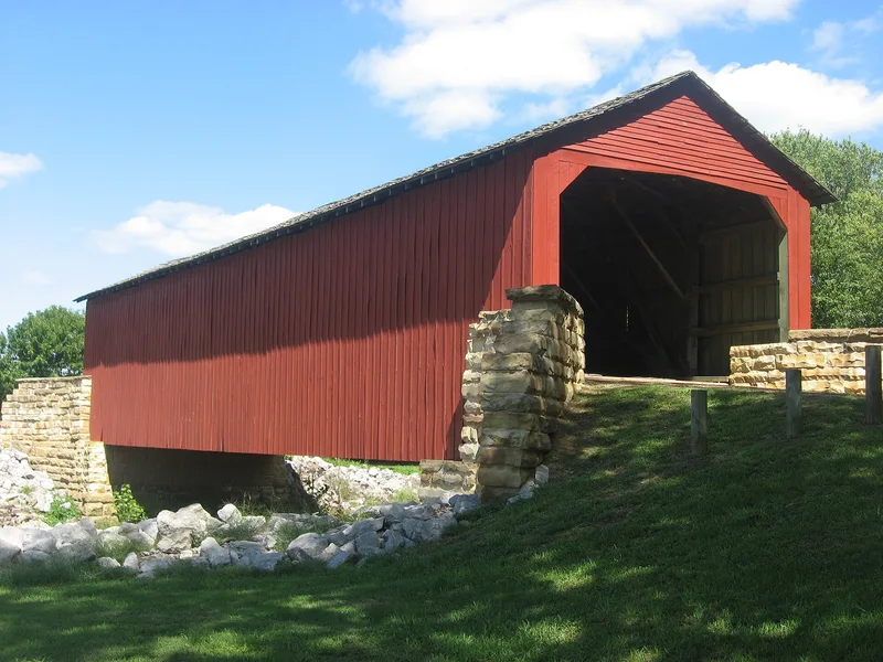
Mary's River Covered Bridge is an 86-foot timber span completed in 1854 over the Little Mary's River, northeast of Chester, Illinois. Built of hand-hewn native white oak, it uses a Burr Arch design with double arches on either side of the King posts. It is 17 feet 8 inches wide with 12 feet of vertical clearance and rests on its original stone abutments. Most of the original timber survives, though the floor, joists, roof and siding have been replaced and steel channels now support the lower chord. The bridge carried a planked toll road between Bremen and Chester, built so wheat, corn and lumber could reach river boats at Chester. A Mr. Hartmann financed the road and bridge, and the county bought them between 1870 and 1875. The bridge was in constant use until 1930. It is thought to be the second oldest covered bridge in Illinois and the only one of its type remaining in Southern Illinois. It now sits in a picnic area maintained by the state.
Significance in brief: The nomination presents it as a rare surviving covered bridge, thought to be the second oldest in Illinois and the only one of its type left in Southern Illinois. It was part of a privately financed plank toll road that linked Bremen to the Mississippi River trading town of Chester. The form also credits the early builders' use of a cover to protect the structure from deterioration.
Machine-generated summary. This summary was generated by a language model from the official nomination document and has not been reviewed line by line by an editor. It may contain errors. Check the source document before relying on any detail. Source: nomination document (PDF) · National Archives catalog entry. NRHP reference 74000771, listed December 31, 1974. Summary generated October 2026 (model claude-sonnet-5-5, prompt v1.0-2026-10-29, confidence medium).
Key facts
| Address | About 4 mi. NE of Chester on IL 150, Chester |
|---|---|
| County | Randolph County |
| Listed | December 31, 1974 |
| Reference number | 74000771 |
| Resource type | Structure |
| Period of significance | 19th Century (specific date 1853) |
| Architectural style | Burr Arch design with double arches on either side of the King posts |
| Areas of significance | Commerce, Engineering, Transportation |
| Level of significance | State, Local |
| Status (as stated in the nomination) | Listed in good condition and altered. Maintained by the state Division of Highways in a public picnic area. Floor, floor joists, roof and siding have been replaced, and steel channels support the lower chord. |
| Acreage | 0.5 |
| Coordinates | 37.94861, -89.76581 (NPS GIS) |
What listing means for this property
For a publicly owned building or structure, listing mainly matters when federal funds, permits or licences are involved: projects then go through Section 106 review so effects on the property are considered. Listing also strengthens applications for preservation grants and, for leased income-producing uses, can enable the federal rehabilitation tax credit.
General information, not legal or tax advice. Rules change; confirm with your State Historic Preservation Office or a qualified adviser.
Sources and further reading
- National Park Service, National Register of Historic Places database (snapshot May 2026), reference 74000771.
- Nomination form (PDF, National Archives) — catalog entry
- Wikipedia article (used for cross-checking only; text not reproduced here)
- Wikidata Q15249510
- This listing as JSON
Last updated October 2026. Found an error? See the editorial policy for how to report it.