Golconda Historic District

Why it's listed
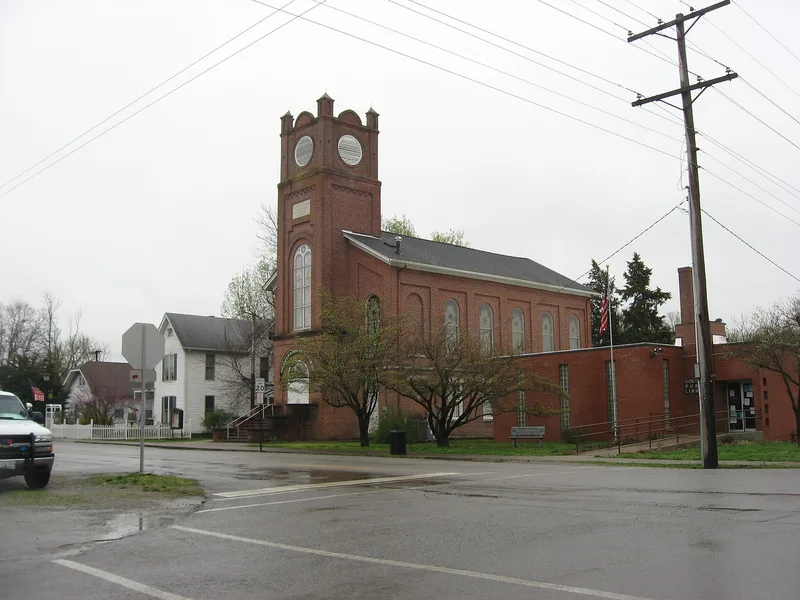
Golconda is a small Ohio River town and the seat of Pope County in southeastern Illinois. This district takes in most of the town north of Pope Street, along with a large stretch of open land to the north, about 437 acres in all. Settlement began in 1798 under Major James Lusk, who ran a ferry and tavern, and the town was later laid out and named Golconda by Green B. Field. Main Street keeps two-story brick commercial buildings with decorative brick trim from the era of river trade. A brick and stone courthouse built in 1872 sits in a tree-shaded square. Surrounding streets hold sturdy frame and brick houses, many built by German craftsmen from the 1860s onward, with the most elaborate Victorian homes dating from the 1880s, when the town reached its peak prosperity. The nomination values the way this nineteenth-century fabric survives, despite flood walls, fires and demolitions after the 1937 flood.
Significance in brief: The nomination argues that Golconda is an early Ohio River town in Illinois that grew slowly after the Civil War, so its nineteenth-century commercial buildings, courthouse and homes survive largely intact. The main street's river-trade-era storefronts, the 1872 courthouse and the many Victorian houses from the town's 1880s peak are described as an unusually well-preserved ensemble. It was judged to be of local significance.
Machine-generated summary. This summary was generated by a language model from the official nomination document and has not been reviewed line by line by an editor. It may contain errors. Check the source document before relying on any detail. Source: nomination document (PDF) · National Archives catalog entry. NRHP reference 76000726, listed October 22, 1976. Summary generated October 2026 (model claude-sonnet-5-5, prompt v1.0-2026-10-29, confidence medium).
Key facts
| Address | IL 146, Golconda |
|---|---|
| County | Pope County |
| Listed | October 22, 1976 |
| Reference number | 76000726 |
| Resource type | District |
| Architectural style | Victorian-era houses and two-story brick commercial buildings with decorative brickwork; no formal style classification given |
| Areas of significance | Commerce, Transportation, Exploration/Settlement, Architecture |
| Level of significance | State |
| Status (as stated in the nomination) | Condition marked good; the town remains an occupied community with homes, shops and a courthouse in use, and the form reports no obvious intrusions. |
| Acreage | 276 |
| Coordinates | 37.37366, -88.48444 (NPS GIS) |
What listing means for this property
This is a historic district. Buildings within its boundary are either contributing (they add to the district's significance) or non-contributing. Owners of contributing income-producing buildings can claim the 20% federal rehabilitation tax credit; homeowners should look at state credits. National Register districts impose no design review by themselves; a local historic district ordinance, if one exists, does (the difference explained).
General information, not legal or tax advice. Rules change; confirm with your State Historic Preservation Office or a qualified adviser.
Sources and further reading
- National Park Service, National Register of Historic Places database (snapshot May 2026), reference 76000726.
- Nomination form (PDF, National Archives) — catalog entry
- Wikipedia article (used for cross-checking only; text not reproduced here)
- Wikidata Q5578483
- This listing as JSON
Last updated October 2026. Found an error? See the editorial policy for how to report it.