Union Miners Cemetery

Why it's listed
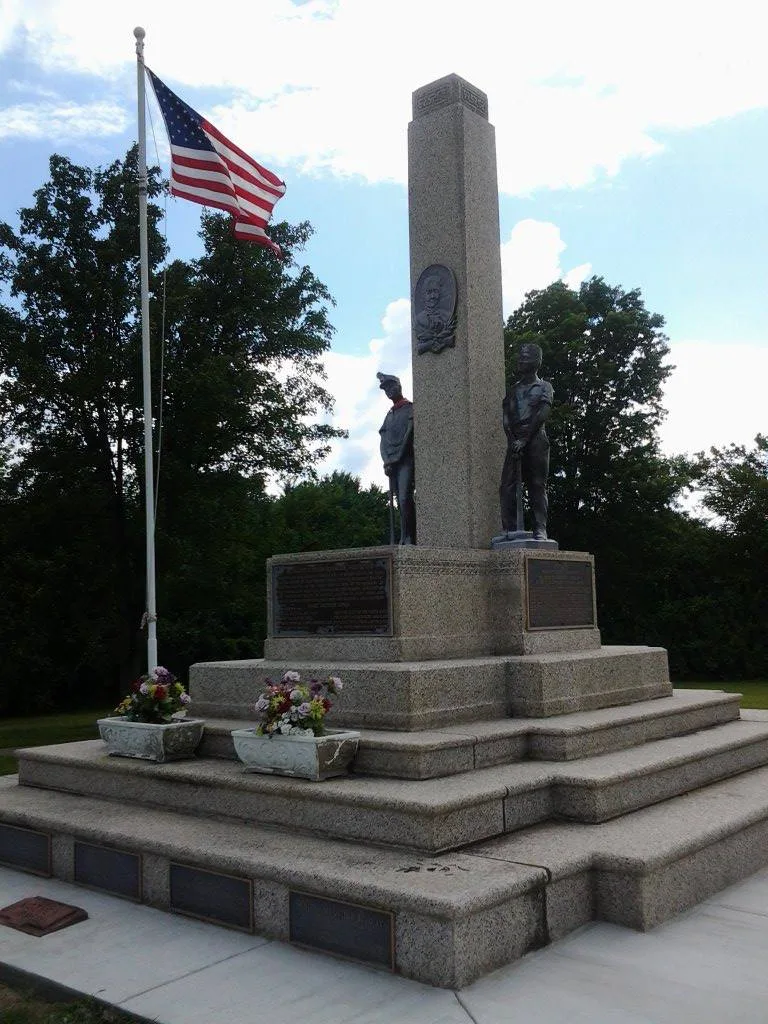
Union Miners Cemetery covers about three acres on both sides of an oiled road half a mile north of the city park in Mt. Olive, Illinois. Its centerpiece is a 22-foot pink granite monument, flanked by two bronze miners and bearing plaques to Mary "Mother" Jones, organizer "General" Alexander Bradley, men killed in the 1898 Virden riot, and twenty-one martyrs of the Progressive Miners of America. The nomination describes the cemetery as the only union-owned cemetery in the nation. It holds the graves of hundreds of miners and of people involved in early coal unionism in Illinois, including three of the four Mt. Olive miners killed at Virden. Since 1899 it has hosted a Miners Day celebration each October 12. The monument was dedicated in 1936 before a crowd said to number 50,000. The nomination presents the site as an illustration of coal mining as a once common way of life and of unionism's place in American labor history.
Significance in brief: The nomination calls it the only union-owned cemetery in the nation. It holds the graves of participants in the early major events of Illinois coal unionism, including victims of the 1898 Virden riot. It is also the burial place of Mary "Mother" Jones and the site of annual Miners Day celebrations since 1899.
Machine-generated summary. This summary was generated by a language model from the official nomination document and has not been reviewed line by line by an editor. It may contain errors. Check the source document before relying on any detail. Source: nomination document (PDF) · National Archives catalog entry. NRHP reference 72000463, listed October 18, 1972. Summary generated October 2026 (model claude-sonnet-5-5, prompt v1.0-2026-10-29, confidence high).
Key facts
| Address | 0.5 mi. N of Mount Olive city park, Mount Olive |
|---|---|
| County | Macoupin County |
| Listed | October 18, 1972 |
| Reference number | 72000463 |
| Resource type | Site |
| Architect / builder | Monument built by the Progressive Mine Workers of America |
| Areas of significance | Social History |
| Level of significance | State |
| Status (as stated in the nomination) | Condition rated good, unaltered, on its original site, and in use as a cemetery. Open to the public without restriction. |
| Acreage | 3 |
| Coordinates | 39.08115, -89.73149 (NPS GIS) |
What listing means for this property
Sites (archaeological sites, battlefields, landscapes) are often listed with a restricted address to protect them from looting or disturbance. Listing is honorary for private owners; federal undertakings on or near the site go through Section 106 review, and state laws may protect burials and artefacts regardless of listing.
General information, not legal or tax advice. Rules change; confirm with your State Historic Preservation Office or a qualified adviser.
Sources and further reading
- National Park Service, National Register of Historic Places database (snapshot May 2026), reference 72000463.
- Nomination form (PDF, National Archives) — catalog entry
- Wikipedia article (used for cross-checking only; text not reproduced here)
- Wikidata Q7885850
- This listing as JSON
Last updated October 2026. Found an error? See the editorial policy for how to report it.