Starved Rock
Also known as: 11-Ls-12; Site of Fort St. Louis-Le Rocher

Why it's listed
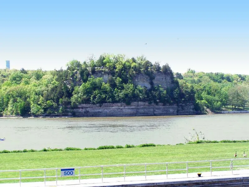
Starved Rock is a flat-topped sandstone bluff rising about 150 feet from the south bank of the Illinois River, near Ottawa in La Salle County, Illinois. It is the centerpiece of Starved Rock State Park. In the winter of 1682-83, La Salle and Henri de Tonti built Fort St. Louis on its summit, using palisades and houses along the edge of the rock. La Salle chose it as the base for governing and developing the Mississippi Valley after claiming the region for France, and it was intended as one link in a chain of forts to hem in the English colonies. The Illinois resettled nearby, and several other tribes gathered around the fort. Tonti abandoned the post in 1691, and it was permanently given up in 1718. No visible remains of the fort survive. At least four archeological investigations have found pits holding mixed European and Indian materials. Today a path, stairs and a walkway serve visitors on top of the rock.
Significance in brief: Fort St. Louis, built by La Salle and Henri de Tonti, was the first major center of French influence in the Illinois country and the base for La Salle's planned administration of the Mississippi Valley. It was meant to be a link in a chain of forts to confine the English colonies to the east coast. Its position above the Illinois River rapids controlled a main route from Canada to the south, and the site is associated with the nearby Kaskaskia-Illinois villages.
Machine-generated summary. This summary was generated by a language model from the official nomination document and has not been reviewed line by line by an editor. It may contain errors. Check the source document before relying on any detail. Source: nomination document (PDF) · National Archives catalog entry. NRHP reference 66000325, listed October 15, 1966. Summary generated October 2026 (model claude-sonnet-5-5, prompt v1.0-2026-10-29, confidence high).
Key facts
| Address | 6 mi. from Ottawa on IL 71, Starved Rock State Park, Ottawa |
|---|---|
| County | LaSalle County |
| Listed | October 15, 1966 |
| Reference number | 66000325 |
| Resource type | Site |
| Period of significance | 1682-83--1691 |
| Areas of significance | Historic - Non-Aboriginal, Exploration/Settlement |
| Level of significance | National |
| National Historic Landmark | Yes, designated October 9, 1960 |
| Status (as stated in the nomination) | The form describes the property as good condition, occupied, a public park. No visible remains of the 17th century fort survive on the top of the rock; a path, stairs and a walkway are present. |
| Acreage | 25 |
| Coordinates | 41.32034, -88.99064 (NPS GIS) |
What listing means for this property
Sites (archaeological sites, battlefields, landscapes) are often listed with a restricted address to protect them from looting or disturbance. Listing is honorary for private owners; federal undertakings on or near the site go through Section 106 review, and state laws may protect burials and artefacts regardless of listing.
General information, not legal or tax advice. Rules change; confirm with your State Historic Preservation Office or a qualified adviser.
Sources and further reading
- National Park Service, National Register of Historic Places database (snapshot May 2026), reference 66000325.
- Nomination form (PDF, National Archives) — catalog entry
- Wikidata Q32358657
- This listing as JSON
Last updated October 2026. Found an error? See the editorial policy for how to report it.