Walnut Grove Farm

Why it's listed
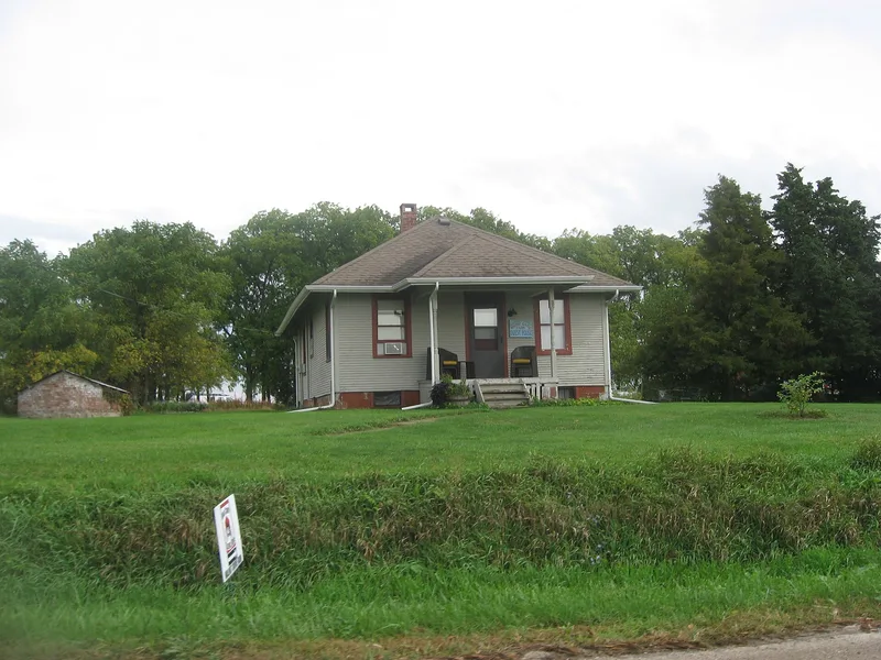
Walnut Grove Farm is a working farm of about 360 acres one mile north of Knoxville, Illinois, named for two stands of walnut trees at the edges of its building clusters. The land was deeded to George A. Charles by the U.S. government in 1835, and his family grew the holdings into a cattle operation of nearly 2000 acres by 1887. The surviving farmstead includes a three-level bank barn of about 1865 with a sandstone foundation and hand-hewn pegged framing, a 1916 middle barn, an east barn, a hog farrowing house, a tenant house, a brick water storage building and a Second Empire farmhouse with a mansard roof. The prairie soils supported corn and cattle feeding, and nearby sandstone quarries supplied building stone. Members of the Charles family also served on county boards and in farm organizations. The layout of buildings, groves, pastures and fields has changed little, though the balance has shifted toward corn.
Significance in brief: The farm was part of the Charles family holdings, which grew from an 1835 land grant into a cattle operation of nearly 2000 acres by 1887. It shows how corn and cattle farming developed in Knox County on prairie and savanna land. Its bank barn, other barns, Second Empire house and farmstead layout remain largely intact. Members of the Charles family were also involved in county government and agricultural organizations.
Machine-generated summary. This summary was generated by a language model from the official nomination document and has not been reviewed line by line by an editor. It may contain errors. Check the source document before relying on any detail. Source: nomination document (PDF) · National Archives catalog entry. NRHP reference 89001114, listed August 24, 1989. Summary generated October 2026 (model claude-sonnet-5-5, prompt v1.0-2026-10-29, confidence medium).
Key facts
| Address | Knox Station Rd., 1 mi. S of Knoxville, Knoxville |
|---|---|
| County | Knox County |
| Listed | August 24, 1989 |
| Reference number | 89001114 |
| Resource type | District |
| Architectural style | Late Victorian/Second Empire |
| Areas of significance | Agriculture |
| Level of significance | Local |
| Status (as stated in the nomination) | Still a working farm with corn, hay and cattle. The bank barn was being rehabilitated in 1988 as part of a tax credit project. |
| Acreage | 360 |
| Coordinates | 40.91903, -90.26367 (NPS GIS) |
What listing means for this property
This is a historic district. Buildings within its boundary are either contributing (they add to the district's significance) or non-contributing. Owners of contributing income-producing buildings can claim the 20% federal rehabilitation tax credit; homeowners should look at state credits. National Register districts impose no design review by themselves; a local historic district ordinance, if one exists, does (the difference explained).
General information, not legal or tax advice. Rules change; confirm with your State Historic Preservation Office or a qualified adviser.
Sources and further reading
- National Park Service, National Register of Historic Places database (snapshot May 2026), reference 89001114.
- Nomination form (PDF, National Archives) — catalog entry
- Wikipedia article (used for cross-checking only; text not reproduced here)
- Wikidata Q25204506
- This listing as JSON
Last updated October 2026. Found an error? See the editorial policy for how to report it.