Apple River Fort Site
Also known as: 11jd298

Why it's listed
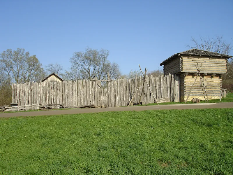
Apple River Fort Site in Elizabeth, Jo Daviess County, Illinois, marks the ground where lead-mining settlers raised a hasty log stockade in May 1832 as Black Hawk's band moved through the region. The fort stood on a knoll near a spring along the Kellogg Trail, and Black Hawk with about 150 warriors attacked it on June 24, 1832, fighting for about 45 minutes before withdrawing. The fort was dismantled in the late 1840s, and its logs went into a barn. The land was later used mainly as pasture, so subsurface remains survived. Archaeological work in 1995 located the stockade trench, about 48 by 68 feet, along with cellars, pits and more than 2,100 artifacts including ceramics, lead shot and household goods. These finds corrected the sketchy written accounts and illuminate settler daily life from the late 1820s to the mid 1840s. Much of the evidence remains unexcavated, and a reconstructed fort stands nearby, outside the listed area.
Significance in brief: The site is tied to the 1832 Black Hawk War, when Black Hawk's band attacked the fort on June 24, 1832. Excavation showed the actual size and layout of the stockade and produced over 2,100 artifacts showing settler life in a lead-mining community from the late 1820s to the mid 1840s. Unexcavated deposits remain for future research.
Machine-generated summary. This summary was generated by a language model from the official nomination document and has not been reviewed line by line by an editor. It may contain errors. Check the source document before relying on any detail. Source: nomination document (PDF) · National Archives catalog entry. NRHP reference 97001332, listed November 7, 1997. Summary generated October 2026 (model claude-sonnet-5-5, prompt v1.0-2026-10-29, confidence high).
Key facts
| Address | 0.25 mi. ESE of jct. of Mrytle and Illinois Sts., Elizabeth |
|---|---|
| County | Jo Daviess County |
| Listed | November 7, 1997 |
| Reference number | 97001332 |
| Resource type | Site |
| Period of significance | Late 1820s-mid 1840s (Criterion D); 1832 (Criterion A) |
| Architectural style | No style |
| Criteria |
|
| Areas of significance | Military, Agriculture, Historic - Non-Aboriginal |
| Level of significance | State |
| Status (as stated in the nomination) | The original fort site is preserved undisturbed and covered with grass, with a reconstructed fort built nearby to the southeast and outside the nominated area. Interpretive center plans were under way. |
| Acreage | 0.5 |
| Coordinates | 42.31811, -90.21440 (NPS GIS) |
What listing means for this property
Sites (archaeological sites, battlefields, landscapes) are often listed with a restricted address to protect them from looting or disturbance. Listing is honorary for private owners; federal undertakings on or near the site go through Section 106 review, and state laws may protect burials and artefacts regardless of listing.
General information, not legal or tax advice. Rules change; confirm with your State Historic Preservation Office or a qualified adviser.
Sources and further reading
- National Park Service, National Register of Historic Places database (snapshot May 2026), reference 97001332.
- Nomination form (PDF, National Archives) — catalog entry
- Wikipedia article (used for cross-checking only; text not reproduced here)
- Wikidata Q4781224
- This listing as JSON
Last updated October 2026. Found an error? See the editorial policy for how to report it.