Ryan Round Barn

Why it's listed
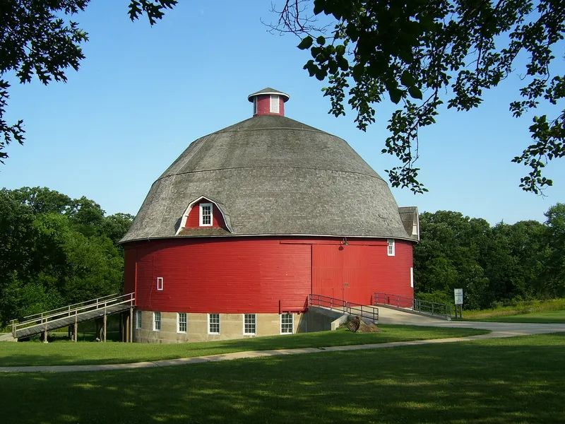
Set on the side of a rolling gully in Johnson-Sauk Trail State Park, about six miles north of Kewanee, this round barn dates to 1910. It is a frame structure roughly 61 feet high to the top of its cupola and 74 feet in diameter, with an 11-foot central silo. A reinforced concrete wall eight feet high forms its base. Above that, vertical fir studs carry horizontal siding that was apparently soaked and bent to follow the curve. The roof is built of hoop-like wooden strips and rests on the silo as its main support. Four gambrel dormers and double-hung windows light the three and a half levels inside. The nomination identifies it as the largest and best example of a round barn known in Illinois. Because the type is uncommon, and because this barn is in such good repair, it was judged worthy of special recognition for both its agricultural and technological interest.
Significance in brief: The nomination calls it the largest and best example of the round barn type known in Illinois. It is seen as an instructive example of an unusual structure and of efficient agricultural building, with technological as well as agricultural interest. Its good state of repair gives it an advantage over other round barns in the state.
Machine-generated summary. This summary was generated by a language model from the official nomination document and has not been reviewed line by line by an editor. It may contain errors. Check the source document before relying on any detail. Source: nomination document (PDF) · National Archives catalog entry. NRHP reference 74000762, listed December 31, 1974. Summary generated October 2026 (model claude-sonnet-5-5, prompt v1.0-2026-10-29, confidence medium).
Key facts
| Address | 6 mi. N of Kewanee, Kewanee |
|---|---|
| County | Henry County |
| Listed | December 31, 1974 |
| Reference number | 74000762 |
| Resource type | Building |
| Period of significance | 20th Century (1910) |
| Architectural style | Round barn |
| Areas of significance | Agriculture, Architecture |
| Level of significance | State |
| Status (as stated in the nomination) | Condition listed as good; altered; on original site. Owned by the State of Illinois and under consideration for use as a park office and/or museum. |
| Acreage | 1 |
| Coordinates | 41.32411, -89.89502 (NPS GIS) |
What listing means for this property
National Register listing is honorary: it recognises significance and does not restrict what a private owner may do without federal money or permits. It unlocks the 20% federal rehabilitation tax credit for income-producing buildings, state credits in many states, and Section 106 review when federal agencies are involved. See what listing means in practice.
General information, not legal or tax advice. Rules change; confirm with your State Historic Preservation Office or a qualified adviser.
Sources and further reading
- National Park Service, National Register of Historic Places database (snapshot May 2026), reference 74000762.
- Nomination form (PDF, National Archives) — catalog entry
- Wikipedia article (used for cross-checking only; text not reproduced here)
- Wikidata Q7384476
- This listing as JSON
Last updated October 2026. Found an error? See the editorial policy for how to report it.