Dresden Island Lock and Dam Historic District
Also known as: Lock & Dam 4
Why it's listed
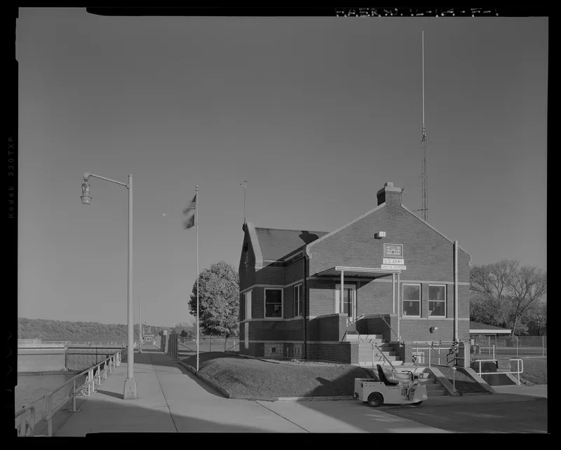
Dresden Island Lock and Dam is a navigation complex on the Illinois River near Morris, built between 1929 and 1933 and opened in 1933. The district contains a lock with a 22-foot lift and a 110 by 600 foot chamber, an unfinished auxiliary lock, a 1,505.5-foot concrete and earth dam, and a red brick control station with gabled bays reminiscent of the Jacobethan style. Walter Mickle Smith, Chief Design Engineer for the Illinois Waterway project, is considered the designer. The facility was part of a slackwater system that allowed commercial barges and towboats to travel the waterway between Chicago and the Mississippi River, and it helps maintain water levels at Lockport and Joliet. It was recognized for its role in transportation and maritime history and as a representative example of Army Corps of Engineers lock and dam design. Gates, machinery and surfaces have been replaced over the years, but the site keeps its original appearance and function. Three small modern buildings are noncontributing.
Significance in brief: The district is significant under Criterion A for its role in the maritime, transportation and industrial history of the Illinois Waterway, which let commercial barges move between Chicago and the Mississippi River. It is significant under Criterion C as a good example of Army Corps of Engineers lock and dam construction of the period. It retains a high degree of integrity despite replaced equipment and surfaces.
Machine-generated summary. This summary was generated by a language model from the official nomination document and has not been reviewed line by line by an editor. It may contain errors. Check the source document before relying on any detail. Source: nomination document (PDF) · National Archives catalog entry. NRHP reference 04000164, listed March 10, 2004. Summary generated October 2026 (model claude-sonnet-5-5, prompt v1.0-2026-10-29, confidence high).
Key facts
| Address | 7521 N. Lock Rd., Morris |
|---|---|
| County | Grundy County |
| Listed | March 10, 2004 |
| Reference number | 04000164 |
| Resource type | District |
| Period of significance | 1929-1951 |
| Architect / builder | Smith, Walter Mickle |
| Architectural style | Other: lock and dam; No style: control station |
| Criteria |
|
| Areas of significance | Transportation, Maritime History, Engineering |
| Level of significance | National |
| Status (as stated in the nomination) | Still an operating lock and dam facility; alterations are described as typical for continued operation. |
| Acreage | 23.4 |
| Coordinates | 41.40033, -88.28184 (NPS GIS) |
What listing means for this property
This is a historic district. Buildings within its boundary are either contributing (they add to the district's significance) or non-contributing. Owners of contributing income-producing buildings can claim the 20% federal rehabilitation tax credit; homeowners should look at state credits. National Register districts impose no design review by themselves; a local historic district ordinance, if one exists, does (the difference explained).
General information, not legal or tax advice. Rules change; confirm with your State Historic Preservation Office or a qualified adviser.
Sources and further reading
- National Park Service, National Register of Historic Places database (snapshot May 2026), reference 04000164.
- Nomination form (PDF, National Archives) — catalog entry
- Wikipedia article (used for cross-checking only; text not reproduced here)
- Wikidata Q5307013
- This listing as JSON
Last updated October 2026. Found an error? See the editorial policy for how to report it.