Ogden-Fettie Site

Why it's listed
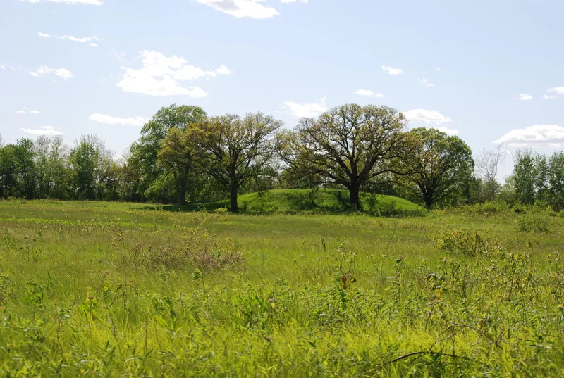
Thirty-five earthen mounds arranged in a crescent make up this archaeological site on a low terrace of the Illinois River flood plain, close to where the Spoon River enters, near Lewistown. The ends of the crescent lie about a mile apart, and the whole site covers roughly seventy acres. A principal mound about fifteen feet high sits near the center, with a five-acre village to its west. Faint scars of a pentagonal moat-type enclosure surround the principal mound, the village and four smaller mounds. The other mounds are one to six feet high, and many have been plowed down. The site is described as the largest group of Woodland mounds in Illinois and as part of a secondary Hopewellian center in the Illinois River Valley. Its pentagonal enclosure resembles those at the Hopewell site in Ohio and is the only one known west of Ohio. Spanning about 100 B.C. to A.D. 400, it retains undisturbed mounds and village deposits, leaving much still to learn.
Significance in brief: The nomination calls it the largest group of Woodland mounds in Illinois and part of a secondary center of Hopewellian activity in the Illinois River Valley. Its pentagonal enclosure resembles those at the classic Hopewell site in Ohio and is the only one known west of Ohio. It represents about five hundred years of prehistory, and no other site of its period and size remains in Illinois.
Machine-generated summary. This summary was generated by a language model from the official nomination document and has not been reviewed line by line by an editor. It may contain errors. Check the source document before relying on any detail. Source: nomination document (PDF) · National Archives catalog entry. NRHP reference 72000458, listed July 31, 1972. Summary generated October 2026 (model claude-sonnet-5-5, prompt v1.0-2026-10-29, confidence medium).
Key facts
| Address | S of Lewistown, Lewistown |
|---|---|
| County | Fulton County |
| Listed | July 31, 1972 |
| Reference number | 72000458 |
| Resource type | Site |
| Period of significance | ca. 100 B.C. to A.D. 400 |
| Areas of significance | Prehistoric |
| Level of significance | State |
| Status (as stated in the nomination) | Condition listed as fair and altered; many mounds have been plowed down, and at least fourteen mounds and the village area have not been excavated. Owned partly by an estate and partly by several farmers. |
| Acreage | 200 |
| Coordinates | 40.34087, -90.11832 (NPS GIS) |
What listing means for this property
Sites (archaeological sites, battlefields, landscapes) are often listed with a restricted address to protect them from looting or disturbance. Listing is honorary for private owners; federal undertakings on or near the site go through Section 106 review, and state laws may protect burials and artefacts regardless of listing.
General information, not legal or tax advice. Rules change; confirm with your State Historic Preservation Office or a qualified adviser.
Sources and further reading
- National Park Service, National Register of Historic Places database (snapshot May 2026), reference 72000458.
- Nomination form (PDF, National Archives) — catalog entry
- Wikipedia article (used for cross-checking only; text not reproduced here)
- Wikidata Q22059019
- This listing as JSON
Last updated October 2026. Found an error? See the editorial policy for how to report it.