Babylon Bend Bridge

Why it's listed
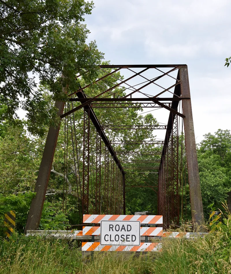
Babylon Bend Bridge is a steel Pratt through truss spanning the Spoon River at Babylon, in Lee Township near Ellisville, Fulton County, Illinois. Built around 1890, it carries Township Road 123 on a single span. The bridge is pin connected, with double eyebars forming the diagonals and bottom chord, a wooden deck, and concrete-faced stone abutments. Its bottom chord measures about 203 feet in length. It was listed as part of a thematic group of metal highway bridges in Fulton County, which together represent surviving truss bridges built between 1883 and 1915. The group illustrates how the county's road system improved as ferries and older iron bridges gave way to modern steel trusses, and it shows changes in steel bridge construction, including Pratt and Parker through trusses, across about 35 years. Reviewers found the bridges largely unaltered and in good condition, although replacement plans for some were mentioned.
Significance in brief: It is one of a thematic group of surviving metal highway truss bridges in Fulton County dating from 1883 to 1915. The group reflects improvements in highway transportation as iron bridges were replaced by up-to-date steel trusses. It also shows variations in steel bridge construction, specifically Pratt and Parker through trusses, over a period of about 35 years.
Machine-generated summary. This summary was generated by a language model from the official nomination document and has not been reviewed line by line by an editor. It may contain errors. Check the source document before relying on any detail. Source: nomination document (PDF) · National Archives catalog entry. NRHP reference 80001355, listed October 29, 1980. Summary generated October 2026 (model claude-sonnet-5-5, prompt v1.0-2026-10-29, confidence medium).
Key facts
| Address | SR 123, Ellisville |
|---|---|
| County | Fulton County |
| Listed | October 29, 1980 |
| Reference number | 80001355 |
| Resource type | Structure |
| Architectural style | Pratt through truss |
| Areas of significance | Engineering, Transportation |
| Level of significance | State |
| Status (as stated in the nomination) | The thematic review notes the surviving bridges are largely unaltered and in good condition, though plans exist to replace some to meet modern traffic and weight demands. |
| Acreage | 0.9 |
| Coordinates | 40.58496, -90.34811 (NPS GIS) |
What listing means for this property
For a publicly owned building or structure, listing mainly matters when federal funds, permits or licences are involved: projects then go through Section 106 review so effects on the property are considered. Listing also strengthens applications for preservation grants and, for leased income-producing uses, can enable the federal rehabilitation tax credit.
General information, not legal or tax advice. Rules change; confirm with your State Historic Preservation Office or a qualified adviser.
Sources and further reading
- National Park Service, National Register of Historic Places database (snapshot May 2026), reference 80001355.
- Nomination form (PDF, National Archives) — catalog entry
- Wikipedia article (used for cross-checking only; text not reproduced here)
- Wikidata Q4838507
- This listing as JSON
Last updated October 2026. Found an error? See the editorial policy for how to report it.