Hennepin Canal Historic District
Also known as: Illinois and Mississippi Canal (1889-1970)

Why it's listed
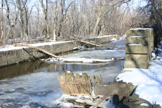
This district preserves 89.8 miles of the Hennepin Canal in northern Illinois, a waterway that crosses the divide between the Illinois and Mississippi Rivers. It includes 60.5 miles of the main line, all 29.3 miles of the feeder line, the Rock River dam built in 1907, the guard lock and 28 of the main line locks. The Army Corps of Engineers acquired the right-of-way between 1891 and 1906. The canal is notable for its engineering. Locks have concrete walls and 170-foot chambers, and fourteen locks originally had Marshall gates, a design unique to this canal by Major W.L. Marshall. Steel-trough aqueducts carried the canal over streams. Commercial use never met expectations. Grain and salt moved in small quantities, record tonnage in 1914 was 12,222, and abandonment was discussed by 1915. Corps work in the 1960s restored some gates and set water depth at five feet. The tow path now serves as a recreational route.
Significance in brief: The canal connected the Illinois and Mississippi Rivers across a divide and includes distinctive engineering features such as Marshall gates, which the form says are unique to this canal, concrete locks and steel-trough aqueducts. The form also records its limited commercial use, with only small amounts of grain and salt hauled and abandonment considered by 1915.
Machine-generated summary. This summary was generated by a language model from the official nomination document and has not been reviewed line by line by an editor. It may contain errors. Check the source document before relying on any detail. Source: nomination document (PDF) · National Archives catalog entry. NRHP reference 78003433, listed May 22, 1978. Summary generated October 2026 (model claude-sonnet-5-5, prompt v1.0-2026-10-29, confidence medium).
Key facts
| Address | W To Moline then N to Rock Falls vic., Hennepin |
|---|---|
| County | Bureau County |
| Listed | May 22, 1978 |
| Reference number | 78003433 |
| Resource type | District |
| Architect / builder | Major W.L. Marshall, U.S. Army Corps of Engineers (officer in charge of construction, designer of the Marshall gate) |
| Areas of significance | Commerce, Economics, Engineering, Transportation, Politics/Government, Social History, Invention |
| Level of significance | National |
| Status (as stated in the nomination) | Overall canal prism described as in good condition; owned by the Illinois Department of Conservation, with the Rock River dam operated by the Illinois Department of Transportation. Water depth is kept to about five feet and the tow path is used for recreation. |
| Acreage | 6031.4 |
| Coordinates | 41.57973, -89.76194 (NPS GIS) |
What listing means for this property
This is a historic district. Buildings within its boundary are either contributing (they add to the district's significance) or non-contributing. Owners of contributing income-producing buildings can claim the 20% federal rehabilitation tax credit; homeowners should look at state credits. National Register districts impose no design review by themselves; a local historic district ordinance, if one exists, does (the difference explained).
General information, not legal or tax advice. Rules change; confirm with your State Historic Preservation Office or a qualified adviser.
Sources and further reading
- National Park Service, National Register of Historic Places database (snapshot May 2026), reference 78003433.
- Nomination form (PDF, National Archives) — catalog entry
- Wikipedia article (used for cross-checking only; text not reproduced here)
- Wikidata Q5714816
- This listing as JSON
Last updated October 2026. Found an error? See the editorial policy for how to report it.