Woodmanston Site
Also known as: Le Conte Plantation

Why it's listed
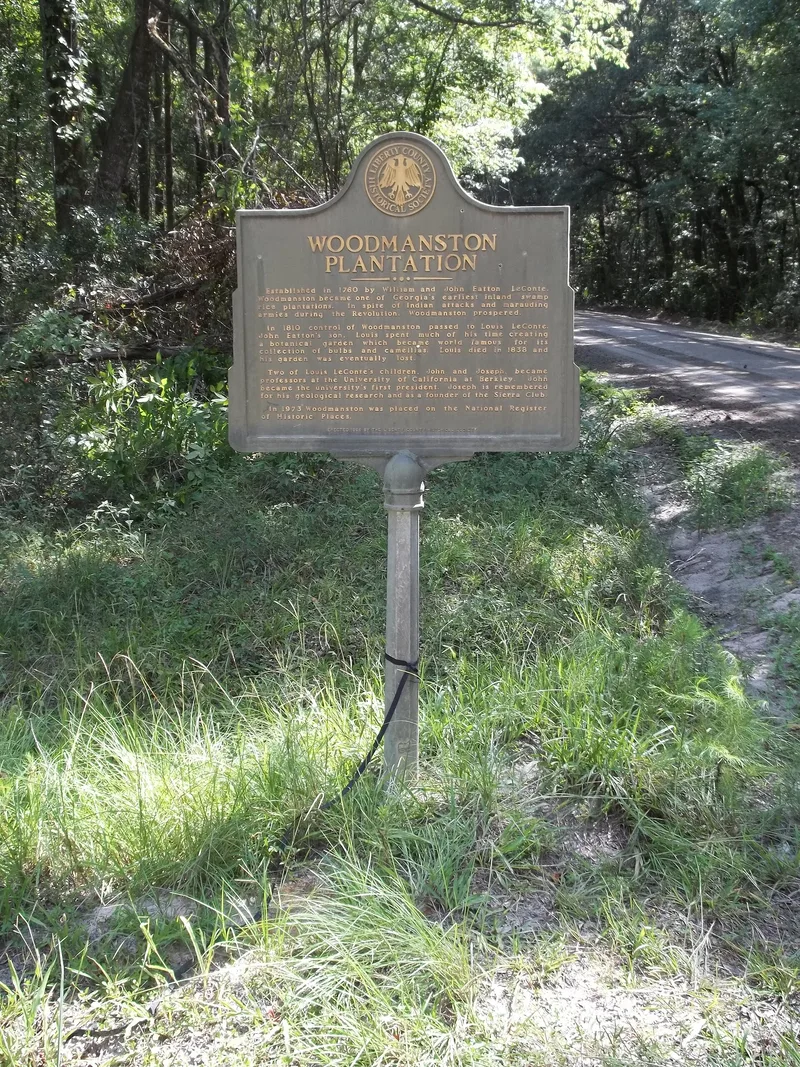
Woodmanston was a coastal Georgia rice plantation southwest of Riceboro, begun by John Eatton LeConte, Sr., who by 1770 chose a low, wet inland tract for growing rice. A dam and dike held back water from the swamp to flood the fields. The first house was burned by British troops in 1779, and a later house was fortified with a stockade against raids. In 1810 his son Louis LeConte settled there permanently, ran the plantation, kept a chemical laboratory and created a botanical and floral garden famous for its camellias and bulbs. His sons Joseph and John later became prominent scientists and educators. After Louis died in 1838 the plantation declined. Today the site is mostly traces of waterways, a lone camellia, two palms and some old trees under dense growth. A 1972 archaeological survey found evidence of a wall trench, brick foundations and china from the house period, so the site is valued mainly for its archaeological potential.
Significance in brief: The site is tied to the LeConte family, who began a rice venture in a swamp and later turned the plantation into a scientific center. Louis LeConte's botanical garden and chemical laboratory became well known in the United States and Europe. His sons Joseph and John went on to scientific careers and helped shape the University of California. The site also retains traces of the rice-growing waterworks and may hold archaeological evidence of the house and stockade.
Machine-generated summary. This summary was generated by a language model from the official nomination document and has not been reviewed line by line by an editor. It may contain errors. Check the source document before relying on any detail. Source: nomination document (PDF) · National Archives catalog entry. NRHP reference 73000626, listed June 18, 1973. Summary generated October 2026 (model claude-sonnet-5-5, prompt v1.0-2026-10-29, confidence medium).
Key facts
| Address | SW of Riceboro off Barrington Rd., Riceboro |
|---|---|
| County | Liberty County |
| Listed | June 18, 1973 |
| Reference number | 73000626 |
| Resource type | Site |
| Period of significance | 18th and 19th centuries; specific dates 1779, 1789, 1810 |
| Areas of significance | Military, Engineering, Education, Social History, Agriculture |
| Level of significance | National |
| Status (as stated in the nomination) | Ruins, altered, original site. Much of the plantation has been clear-cut and planted in pine. Only a lone camellia, two palms, and a few trees remain from the garden. Archaeological evidence survives beneath heavy vegetation. |
| Acreage | 93.2 |
| Coordinates | 31.69896, -81.47241 (NPS GIS) |
What listing means for this property
Sites (archaeological sites, battlefields, landscapes) are often listed with a restricted address to protect them from looting or disturbance. Listing is honorary for private owners; federal undertakings on or near the site go through Section 106 review, and state laws may protect burials and artefacts regardless of listing.
General information, not legal or tax advice. Rules change; confirm with your State Historic Preservation Office or a qualified adviser.
Sources and further reading
- National Park Service, National Register of Historic Places database (snapshot May 2026), reference 73000626.
- Nomination form (PDF, National Archives) — catalog entry
- Wikipedia article (used for cross-checking only; text not reproduced here)
- Wikidata Q38251830
- This listing as JSON
Last updated October 2026. Found an error? See the editorial policy for how to report it.