St. Catherine's Island
Also known as: Guale; Santa Catalina; St. Catherine's Island,One of the Golde

The pin is a point inside the NPS boundary polygon, not a surveyed location.
Why it's listed
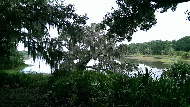
St. Catherines Island is a barrier island off the Georgia coast in Liberty County, roughly half salt marsh and half of the rest wooded. It first mattered as a Spanish outpost. Pedro Menendez de Aviles visited in 1566, soldiers were stationed there, and Jesuits founded the Santa Catalina mission in 1568. Under Spain it served as a leading mission center until attacks forced its abandonment in 1684. Potsherds and debris mark the mission area, which has seen only limited testing. In 1765 Button Gwinnett, later a signer of the Declaration of Independence, bought the island and ran it as a plantation. Part of the main house may date from the 1770s, and it was enlarged after 1929. Tabby slave quarters, old field boundaries and many Indian burial mounds survive. After 1876 the island became a country estate and game preserve, and its long preserve status kept much of its original character.
Significance in brief: From 1566 to 1684 the island was one of the most important Spanish mission centers in the southeastern United States, site of the Mission of Santa Catalina. In 1765 it became the plantation home of Button Gwinnett, a signer of the Declaration of Independence. After 1876 it developed into a notable country estate and private game preserve, which kept its character largely intact.
Machine-generated summary. This summary was generated by a language model from the official nomination document and has not been reviewed line by line by an editor. It may contain errors. Check the source document before relying on any detail. Source: nomination document (PDF) · National Archives catalog entry. NRHP reference 69000332, listed December 16, 1969. Summary generated October 2026 (model claude-sonnet-5-5, prompt v1.0-2026-10-29, confidence medium).
Key facts
| Address | 10 mi. off the GA coast between St. Catherines Sound and Sapelo Sound, South Newport |
|---|---|
| County | Liberty County |
| Listed | December 16, 1969 |
| Reference number | 69000332 |
| Resource type | District |
| Period of significance | 1566-20th Century |
| Areas of significance | Historic - Aboriginal, Historic - Non-Aboriginal, Politics/Government, Religion |
| Level of significance | National |
| National Historic Landmark | Yes, designated December 16, 1969 |
| Status (as stated in the nomination) | Occupied, in excellent condition and maintained as a private preserve and recreational area; not open to the public. No mission-period structures remain, though the Santa Catalina mission site is undisturbed and has had only limited archeological testing (1959). |
| Acreage | 22265 |
| Coordinates | 31.64447, -81.16306 (NPS GIS) |
What listing means for this property
This is a historic district. Buildings within its boundary are either contributing (they add to the district's significance) or non-contributing. Owners of contributing income-producing buildings can claim the 20% federal rehabilitation tax credit; homeowners should look at state credits. National Register districts impose no design review by themselves; a local historic district ordinance, if one exists, does (the difference explained).
General information, not legal or tax advice. Rules change; confirm with your State Historic Preservation Office or a qualified adviser.
Sources and further reading
- National Park Service, National Register of Historic Places database (snapshot May 2026), reference 69000332.
- Nomination form (PDF, National Archives) — catalog entry
- Wikipedia article (used for cross-checking only; text not reproduced here)
- Wikidata Q7587464
- This listing as JSON
Last updated October 2026. Found an error? See the editorial policy for how to report it.