Davis, Jefferson, Capture Site

Why it's listed
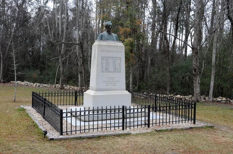
Jefferson Davis, president of the Confederacy, was captured on this site about one and a half miles north of Irwinville, Georgia, in May 1865. Union cavalry from the Fourth Michigan and First Wisconsin closed in on his camp at first light; in the confusion the two Union units skirmished with each other, and two Union soldiers were killed. The party taken included Davis, his wife, his private secretary, and the Postmaster General. The 12.668-acre tract holds woods, a swamp crossed by a trace of the Old Abbeville Road, a granite memorial with bust, and park facilities including a museum and caretaker's house. Research using newspapers, official reports, period maps, and local tradition placed the capture here. The land has been publicly owned since 1920, first by the State of Georgia and then by Irwin County from 1976. Local families preserved and showed the site long before formal programs existed, adding to its importance.
Significance in brief: The nomination argues the site is nationally significant in American political history as the place where the Confederate president was captured at the close of the Civil War, an event with strong psychological meaning for the nation. It also holds significance for the long local veneration of the site, supported by research confirming the location through reports, maps and oral tradition.
Machine-generated summary. This summary was generated by a language model from the official nomination document and has not been reviewed line by line by an editor. It may contain errors. Check the source document before relying on any detail. Source: nomination document (PDF) · National Archives catalog entry. NRHP reference 80001094, listed April 1, 1980. Summary generated October 2026 (model claude-sonnet-5-5, prompt v1.0-2026-10-29, confidence medium).
Key facts
| Address | N of Irwinville, Irwinville |
|---|---|
| County | Irwin County |
| Listed | April 1, 1980 |
| Reference number | 80001094 |
| Resource type | Site |
| Period of significance | 1865 |
| Areas of significance | Military, Politics/Government |
| Level of significance | National |
| Status (as stated in the nomination) | Public park owned by Irwin County, with a museum, caretaker's house, pavilion, restrooms and picnic area; condition rated good. These buildings are described as intrusions that do not contribute to the site's significance. |
| Acreage | 12.7 |
| Coordinates | 31.66527, -83.38675 (NPS GIS) |
What listing means for this property
Sites (archaeological sites, battlefields, landscapes) are often listed with a restricted address to protect them from looting or disturbance. Listing is honorary for private owners; federal undertakings on or near the site go through Section 106 review, and state laws may protect burials and artefacts regardless of listing.
General information, not legal or tax advice. Rules change; confirm with your State Historic Preservation Office or a qualified adviser.
Sources and further reading
- National Park Service, National Register of Historic Places database (snapshot May 2026), reference 80001094.
- Nomination form (PDF, National Archives) — catalog entry
- Wikipedia article (used for cross-checking only; text not reproduced here)
- Wikidata Q6175458
- This listing as JSON
Last updated October 2026. Found an error? See the editorial policy for how to report it.