Cairo Commercial Historic District

Why it's listed
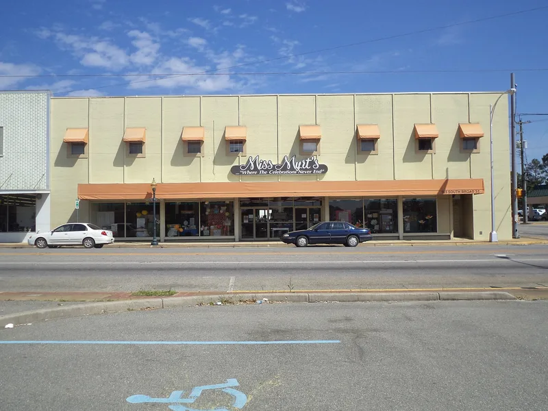
Cairo's historic downtown in Grady County, Georgia, follows North and South Broad Street on either side of the railroad tracks. The district holds 31 contributing buildings, mostly one- to three-story brick commercial rows with shared party walls, along with warehouses, a depot, a theater and a post office. Styles include Commercial Vernacular Victorian, Neoclassical Revival, Stripped Classical and Art Deco. The c. 1908 Citizens Bank is a granite 'vault' type building, and the 1935 post office holds a New Deal mural by Paul Ludwig Gill. The town grew from a plan of about 1866 tied to the Atlantic & Gulf Railroad, producing a 'cross-rail' layout with shops along the main street and warehouses beside the tracks. Cairo became a regional shipping center for cane syrup and other farm goods, and Grady County was formed in 1906 with Cairo as its seat. These links to commerce, transportation, government and architecture support the district's listing.
Significance in brief: The district is significant for its concentration of brick commercial row buildings and for its range of architectural styles from Victorian to Art Deco. It also represents Cairo's commercial, government and railroad history, and a 'cross-rail' railroad town plan dating to about 1866. Its 1935 post office, with a New Deal mural, reflects Depression-era federal work.
Machine-generated summary. This summary was generated by a language model from the official nomination document and has not been reviewed line by line by an editor. It may contain errors. Check the source document before relying on any detail. Source: nomination document (PDF) · National Archives catalog entry. NRHP reference 94000525, listed May 26, 1994. Summary generated October 2026 (model claude-sonnet-5-5, prompt v1.0-2026-10-29, confidence high).
Key facts
| Address | Roughly bounded by Broad St., Railroad Ave. and Martin Luther King Ave., with adjacent properties on 2nd Ave. and 1st St, Cairo |
|---|---|
| County | Grady County |
| Listed | May 26, 1994 |
| Reference number | 94000525 |
| Resource type | District |
| Period of significance | 1866-1943 |
| Architectural style | Late 19th/Early 20th Century Revivals: Classical Revival; Commercial Vernacular Victorian; Stripped Classical; Functional; 20th Century Commercial; Art Deco |
| Criteria |
|
| Areas of significance | Politics/Government, Transportation, Community Planning and Development, Commerce, Architecture |
| Level of significance | Local |
| Status (as stated in the nomination) | Many buildings remain in commercial use; the c. 1880 depot now serves as the police station, and the 1935 post office and the theater are still in the district. Some resources are noncontributing due to later construction or alterations. |
| Acreage | 12 |
| Coordinates | 30.87639, -84.20942 (NPS GIS) |
What listing means for this property
This is a historic district. Buildings within its boundary are either contributing (they add to the district's significance) or non-contributing. Owners of contributing income-producing buildings can claim the 20% federal rehabilitation tax credit; homeowners should look at state credits. National Register districts impose no design review by themselves; a local historic district ordinance, if one exists, does (the difference explained).
General information, not legal or tax advice. Rules change; confirm with your State Historic Preservation Office or a qualified adviser.
Sources and further reading
- National Park Service, National Register of Historic Places database (snapshot May 2026), reference 94000525.
- Nomination form (PDF, National Archives) — catalog entry
- Wikipedia article (used for cross-checking only; text not reproduced here)
- Wikidata Q29094519
- This listing as JSON
Last updated October 2026. Found an error? See the editorial policy for how to report it.