Ebenezer Townsite and Jerusalem Lutheran Church
Also known as: New Ebenezer

Why it's listed
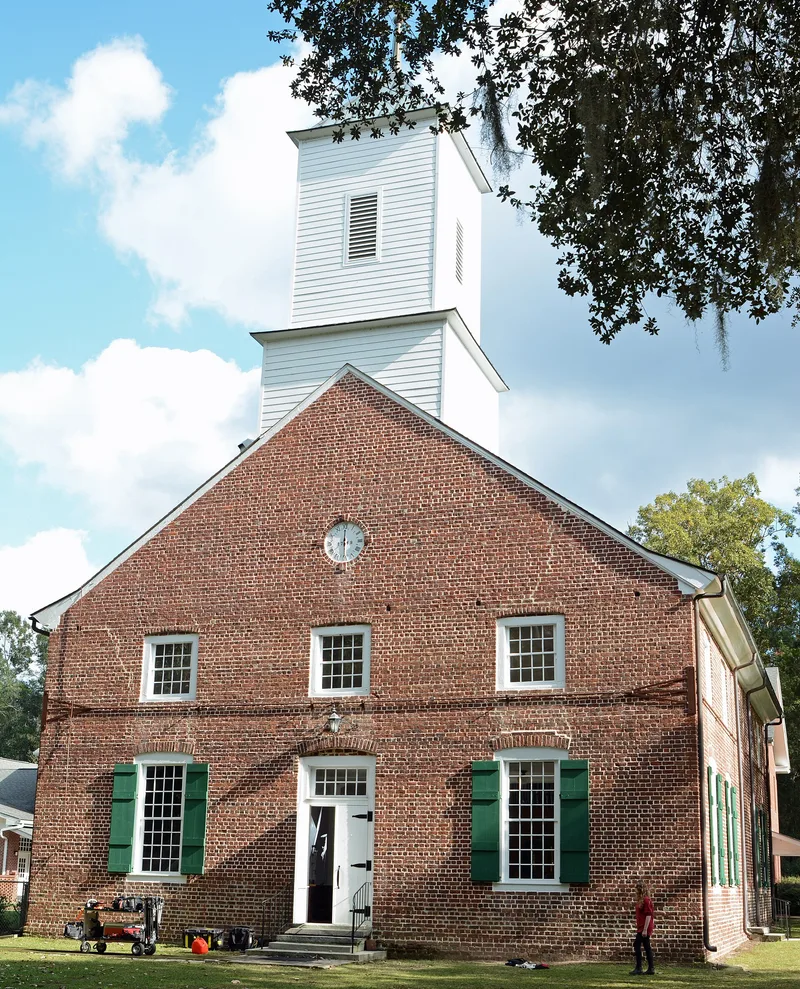
Jerusalem Lutheran Church and the surrounding townsite of New Ebenezer sit on a bluff above the Savannah River east of Springfield, Georgia. Salzburger Protestant refugees moved the settlement here in 1736 after their first site, six miles away, proved unhealthy and infertile. Oglethorpe prescribed a town plan with 160 house lots, a marketplace, common buildings and mills. The Salzburgers opened an orphanage in 1738 and produced over half of the colony's silk after 1750. Nothing of the town survives except the church and cemetery. The one-story brick church, built in 1767-69 from bricks made on the premises, has English bond walls 21 inches thick and an interior balcony. British troops used it as a hospital and stable during the Revolutionary War, and Union soldiers occupied it in 1864. The congregation has been continuous apart from the British occupation. A museum, a Sunday School building and a relocated Salzburger dwelling stand nearby.
Significance in brief: New Ebenezer was the first permanent settlement of the Salzburger colonists in Georgia, founded in 1736. Jerusalem Lutheran Church, built in 1767-69, is described as the oldest surviving church building in the state. The site also had the first Protestant orphanage and the most successful colonial silk production.
Machine-generated summary. This summary was generated by a language model from the official nomination document and has not been reviewed line by line by an editor. It may contain errors. Check the source document before relying on any detail. Source: nomination document (PDF) · National Archives catalog entry. NRHP reference 74000674, listed December 4, 1974. Summary generated October 2026 (model claude-sonnet-5-5, prompt v1.0-2026-10-29, confidence high).
Key facts
| Address | E of Springfield on GA 275 at Savannah River, Springfield |
|---|---|
| County | Effingham County |
| Listed | December 4, 1974 |
| Reference number | 74000674 |
| Resource type | District |
| Period of significance | 1736, 1767-69 (18th Century) |
| Areas of significance | Industry, Military, Religion, Social History, Agriculture |
| Level of significance | National |
| Status (as stated in the nomination) | Condition marked excellent and altered; the property is occupied and used for religious and museum purposes. Only the church and cemetery remain of the original town. |
| Acreage | 48 |
| Coordinates | 32.37567, -81.18201 (NPS GIS) |
What listing means for this property
This is a historic district. Buildings within its boundary are either contributing (they add to the district's significance) or non-contributing. Owners of contributing income-producing buildings can claim the 20% federal rehabilitation tax credit; homeowners should look at state credits. National Register districts impose no design review by themselves; a local historic district ordinance, if one exists, does (the difference explained).
General information, not legal or tax advice. Rules change; confirm with your State Historic Preservation Office or a qualified adviser.
Sources and further reading
- National Park Service, National Register of Historic Places database (snapshot May 2026), reference 74000674.
- Nomination form (PDF, National Archives) — catalog entry
- Wikipedia article (used for cross-checking only; text not reproduced here)
- Wikidata Q3709984
- This listing as JSON
Last updated October 2026. Found an error? See the editorial policy for how to report it.