Kolomoki Mounds

Why it's listed
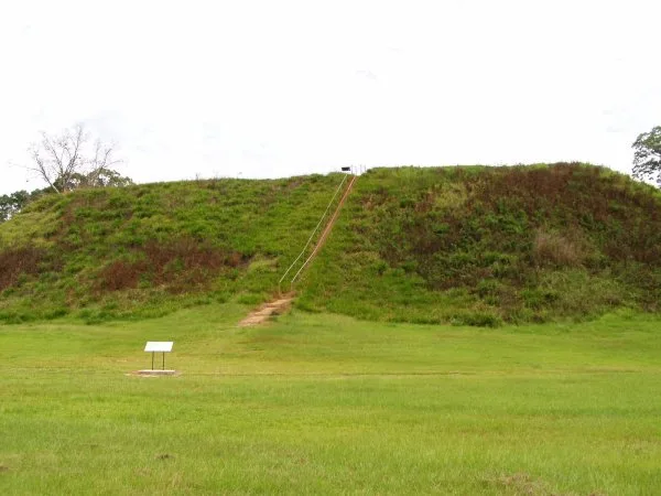
Kolomoki is a large prehistoric mound complex on an elevated spur of land about five miles north of Blakely, Georgia, now protected within a state park. Its mounds include a rectangular temple mound about 60 feet high, several burial mounds and platform mounds, and village areas around a plaza. Excavations beginning in the 1940s, especially those directed by William Sears from 1948, identified Weeden Island, Kolomoki and a small Lamar occupation, plus earlier Archaic debris. Burial mounds held log-lined tombs, cremations, copper ornaments, shell beads and a deposit of 54 complete pottery vessels. Sears recovered tens of thousands of sherds, restorable vessels, points and other artifacts. The site is significant as the type site for the Kolomoki phase and for what it shows about cultural development in southwest Georgia and northwest Florida between about 400 and 1400 A.D. A museum built around part of Mound E displays excavated deposits for visitors.
Significance in brief: The site is the type site for the Kolomoki phase and helps explain cultural chronology and development in southwest Georgia and northwest Florida. Excavations revealed Weeden Island, Kolomoki and small Lamar occupations, along with elaborate mound burial practices and extensive pottery and artifact collections. The form rates its significance as national.
Machine-generated summary. This summary was generated by a language model from the official nomination document and has not been reviewed line by line by an editor. It may contain errors. Check the source document before relying on any detail. Source: nomination document (PDF) · National Archives catalog entry. NRHP reference 66000280, listed October 15, 1966. Summary generated October 2026 (model claude-sonnet-5-5, prompt v1.0-2026-10-29, confidence medium).
Key facts
| Address | 8 mi. N of Blakely on U.S. 27, Kolomoki Mounds State Park, Blakely |
|---|---|
| County | Early County |
| Listed | October 15, 1966 |
| Reference number | 66000280 |
| Resource type | Site |
| Period of significance | 400-1400 A.D. |
| Areas of significance | Prehistoric |
| Level of significance | National |
| National Historic Landmark | Yes, designated July 19, 1964 |
| Status (as stated in the nomination) | Generally in good condition; erosion affects Mound A, and park roads and small structures intrude within the boundaries. A museum is built around part of Mound E. |
| Acreage | 200 |
| Coordinates | 31.46750, -84.93038 (NPS GIS) |
What listing means for this property
Sites (archaeological sites, battlefields, landscapes) are often listed with a restricted address to protect them from looting or disturbance. Listing is honorary for private owners; federal undertakings on or near the site go through Section 106 review, and state laws may protect burials and artefacts regardless of listing.
General information, not legal or tax advice. Rules change; confirm with your State Historic Preservation Office or a qualified adviser.
Sources and further reading
- National Park Service, National Register of Historic Places database (snapshot May 2026), reference 66000280.
- Nomination form (PDF, National Archives) — catalog entry
- Wikipedia article (used for cross-checking only; text not reproduced here)
- Wikidata Q4228402
- This listing as JSON
Last updated October 2026. Found an error? See the editorial policy for how to report it.