Blakely Court Square Historic District

Why it's listed
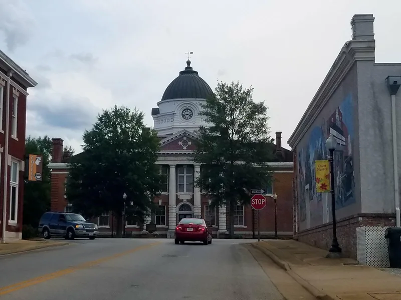
Blakely's historic core is a small commercial downtown arranged around the Early County Courthouse in extreme southwest Georgia. The town was laid out in 1826 as the county seat, using a variation of the Sparta plan: the courthouse sits on the highest ground in a central square, with a street leading out from each side. Around the square are one- and two-story attached brick commercial buildings from the 1880s to the 1920s, along with peanut warehouses. Landmark buildings include the Neoclassical courthouse of 1905, a Stripped Classical post office of 1937 with a mural, the Colonial Revival city hall and fire department of 1939, and an Art Deco jail of 1940. The square also holds a 100-foot wooden flagpole erected in 1861 and several monuments. The district was listed for its town plan, its role as the political and commercial center of Early County, and its representative county-seat architecture. Its period of significance runs from 1826 to 1940.
Significance in brief: The district is significant for its intact Sparta-type town plan, with the courthouse on the highest ground at the center of the square. It is also significant for its attached brick commercial buildings and community landmark buildings typical of Georgia county seats. It was the political and commercial center of Early County from 1826 to 1940.
Machine-generated summary. This summary was generated by a language model from the official nomination document and has not been reviewed line by line by an editor. It may contain errors. Check the source document before relying on any detail. Source: nomination document (PDF) · National Archives catalog entry. NRHP reference 02000452, listed May 9, 2002. Summary generated October 2026 (model claude-sonnet-5-5, prompt v1.0-2026-10-29, confidence high).
Key facts
| Address | Bounded by Powell St., Smith Ave., and Church and Bay Sts., Blakely |
|---|---|
| County | Early County |
| Listed | May 9, 2002 |
| Reference number | 02000452 |
| Resource type | District |
| Period of significance | 1826-1940 |
| Architect / builder | Holman, H. L., Jr. (architect); Jay, W. T. (builder); Morgan and Dillon (architects); Stokes, John B. (builder); U.S. Treasury (architect and builder) |
| Architectural style | Late Victorian (Gothic, Italianate); Colonial Revival, Classical Revival; Moderne, Art Deco; Stripped Classical |
| Criteria |
|
| Areas of significance | Architecture, Community Planning and Development, Politics/Government, Commerce |
| Level of significance | Local |
| Status (as stated in the nomination) | Current functions listed include commercial, government, theater and religious uses; the post office remains in use. |
| Acreage | 30 |
| Coordinates | 31.37826, -84.93420 (NPS GIS) |
What listing means for this property
This is a historic district. Buildings within its boundary are either contributing (they add to the district's significance) or non-contributing. Owners of contributing income-producing buildings can claim the 20% federal rehabilitation tax credit; homeowners should look at state credits. National Register districts impose no design review by themselves; a local historic district ordinance, if one exists, does (the difference explained).
General information, not legal or tax advice. Rules change; confirm with your State Historic Preservation Office or a qualified adviser.
Sources and further reading
- National Park Service, National Register of Historic Places database (snapshot May 2026), reference 02000452.
- Nomination form (PDF, National Archives) — catalog entry
- Wikipedia article (used for cross-checking only; text not reproduced here)
- Wikidata Q40888681
- This listing as JSON
Last updated October 2026. Found an error? See the editorial policy for how to report it.