Gospel Pilgrim Cemetery

Why it's listed
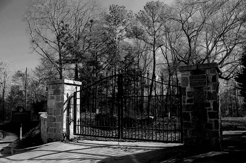
Gospel Pilgrim Cemetery occupies about ten acres on a ridgetop east of downtown Athens, Georgia. The Gospel Pilgrim Society, a lodge-type burial insurance organization, bought the first 8.25 acres in 1882 and added three-quarters of an acre in 1902. Members paid ten cents a week in exchange for a funeral and burial. The cemetery was laid out with roads, nineteen sections and family plots, many outlined with stone, brick or concrete block copings. Surveys counted 2,192 graves and estimate about 3,000 in total, marked by granite stones, concrete tablets, funeral-home markers, fieldstones or only ground depressions. Though woods now cover much of the site, the road system and boundaries survive, and burials continue. The cemetery was listed because it is an unusually well-preserved example of a cemetery planned by an insurance burial society, because it holds the graves of prominent and ordinary African-American residents, and because archaeological work can still yield information unavailable elsewhere.
Significance in brief: The nomination argues the cemetery is the major privately owned African-American cemetery in Athens, planned and laid out by an insurance burial society, with a well-preserved original plan and funerary art marking graves of prominent and ordinary residents. It also qualifies for the information it has already yielded through archaeological investigation and could yield in future, given the near absence of maps, plats and burial records.
Machine-generated summary. This summary was generated by a language model from the official nomination document and has not been reviewed line by line by an editor. It may contain errors. Check the source document before relying on any detail. Source: nomination document (PDF) · National Archives catalog entry. NRHP reference 06000285, listed April 19, 2006. Summary generated October 2026 (model claude-sonnet-5-5, prompt v1.0-2026-10-29, confidence medium).
Key facts
| Address | 530 Fourth St., Athens |
|---|---|
| County | Clarke County |
| Listed | April 19, 2006 |
| Reference number | 06000285 |
| Resource type | Site |
| Period of significance | 1882-1956 |
| Criteria |
|
| Areas of significance | Historic - Non-Aboriginal, Art, Black, Landscape Architecture, Social History |
| Level of significance | State |
| Status (as stated in the nomination) | Still used as a cemetery as of 2006; heavily wooded and overgrown but in generally good condition, with a gate at the Fourth Street entrance and a reclamation effort begun in 2002. |
| Acreage | 10.1 |
| Coordinates | 33.96895, -83.36118 (NPS GIS) |
What listing means for this property
Sites (archaeological sites, battlefields, landscapes) are often listed with a restricted address to protect them from looting or disturbance. Listing is honorary for private owners; federal undertakings on or near the site go through Section 106 review, and state laws may protect burials and artefacts regardless of listing.
General information, not legal or tax advice. Rules change; confirm with your State Historic Preservation Office or a qualified adviser.
Sources and further reading
- National Park Service, National Register of Historic Places database (snapshot May 2026), reference 06000285.
- Nomination form (PDF, National Archives) — catalog entry
- Wikipedia article (used for cross-checking only; text not reproduced here)
- Wikidata Q19866868
- This listing as JSON
Last updated October 2026. Found an error? See the editorial policy for how to report it.