Wormsloe Plantation

Why it's listed
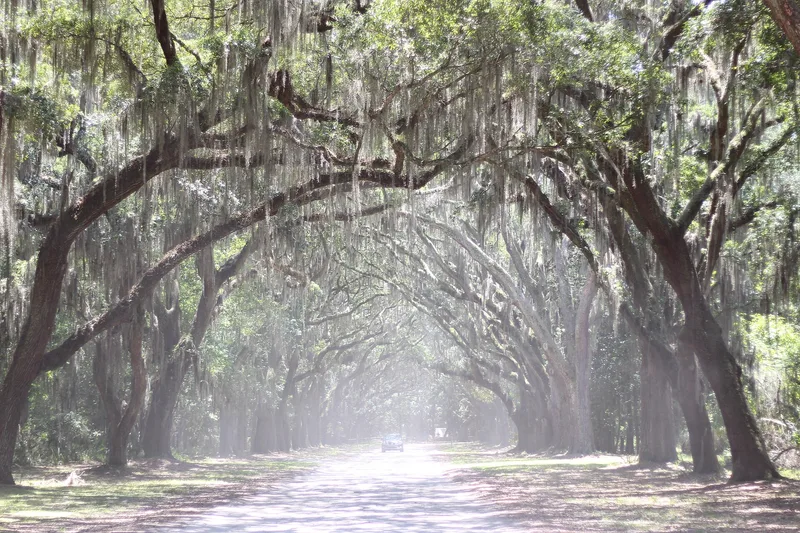
Wormsloe Plantation is a large coastal estate on the Isle of Hope near Savannah, Georgia, with a smaller tract on Long Island. Noble Jones, one of the original English colonists, leased the land in 1736 and developed it as a country estate and experimental farm rather than a typical crop plantation. Around 1739 he built a tabby fortified house enclosed by an eight-foot wall with corner bastions; about a quarter of the wall still stands. The grounds also hold a house begun in 1828 and much altered since, extensive gardens, a 1907 library, a Confederate earthwork, and a mile-long avenue of oaks. Five generations of the family worked in medicine, politics and history, and built a major collection of historical books. The estate was listed for its agricultural, architectural, military and conservation importance, and for the survival of its natural landscape. Much of the land was being transferred to the state for preservation.
Significance in brief: The nomination argues that Wormsloe was established by an original English colonist and has stayed with the same family for over 200 years. It remained largely unaltered as a country estate and experimental farm. The tabby fortified house is described as one of few remaining examples of fortified domestic architecture in coastal Georgia. The estate also has Civil War associations and a notable family library.
Machine-generated summary. This summary was generated by a language model from the official nomination document and has not been reviewed line by line by an editor. It may contain errors. Check the source document before relying on any detail. Source: nomination document (PDF) · National Archives catalog entry. NRHP reference 73000615, listed April 26, 1973. Summary generated October 2026 (model claude-sonnet-5-5, prompt v1.0-2026-10-29, confidence medium).
Key facts
| Address | Isle of Hope and Long Island, Savannah |
|---|---|
| County | Chatham County |
| Listed | April 26, 1973 |
| Reference number | 73000615 |
| Resource type | District |
| Areas of significance | Military, Politics/Government, Architecture, Agriculture |
| Level of significance | National |
| Status (as stated in the nomination) | Described as a private residence with the main house, library and gardens to remain with the family, while about 800 acres including the fort ruins were being transferred to the State of Georgia. Condition is marked fair, with some ruins. |
| Acreage | 822 |
| Coordinates | 31.96502, -81.07037 (NPS GIS) |
What listing means for this property
This is a historic district. Buildings within its boundary are either contributing (they add to the district's significance) or non-contributing. Owners of contributing income-producing buildings can claim the 20% federal rehabilitation tax credit; homeowners should look at state credits. National Register districts impose no design review by themselves; a local historic district ordinance, if one exists, does (the difference explained).
General information, not legal or tax advice. Rules change; confirm with your State Historic Preservation Office or a qualified adviser.
Sources and further reading
- National Park Service, National Register of Historic Places database (snapshot May 2026), reference 73000615.
- Nomination form (PDF, National Archives) — catalog entry
- Wikipedia article (used for cross-checking only; text not reproduced here)
- Wikidata Q8036892
- This listing as JSON
Last updated October 2026. Found an error? See the editorial policy for how to report it.