Savannah and Ogeechee Canal

Why it's listed
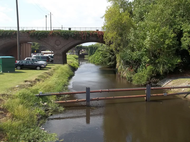
Built between 1826 and 1830, this 16.5-mile barge canal links the Savannah and Ogeechee rivers. When finished it was 48 feet wide at the top, 33 feet at the base and five feet deep, with six locks and five lock keeper's houses after 1840s improvements. Barges moved lumber, cotton and rice to Savannah's port and manufactured goods inland, and the canal supported brickyards, foundries and wharves on the city's west side, many dependent on enslaved labor. In December 1864 Union and Confederate soldiers skirmished along it during Sherman's March to the Sea; it was repaired by 1866. The Central of Georgia Railway, which bought stock in 1888, helped end its commercial role. In 1933 WPA workers drained portions and linked it to the Springfield Canal for drainage and flood control. Today sections of the earthen channel, remains of all six locks, a brick aqueduct and the Half Moon Lake dam survive, though highways, fill and development have interrupted the route.
Significance in brief: The canal carried lumber, cotton, rice and manufactured goods between interior Georgia and the port of Savannah, and supported industries on Savannah's west side. It was the scene of skirmishes during Sherman's March to the Sea in 1864. Railroad competition, floods and epidemic disease led to its decline, and in the 1930s it was folded into a regional drainage system with WPA labor.
Machine-generated summary. This summary was generated by a language model from the official nomination document and has not been reviewed line by line by an editor. It may contain errors. Check the source document before relying on any detail. Source: nomination document (PDF) · National Archives catalog entry. NRHP reference 97000814, listed August 11, 1997. Summary generated October 2026 (model claude-sonnet-5-5, prompt v1.0-2026-10-29, confidence medium).
Key facts
| Address | Roughly along I-95, between the Savannah and Ogeechee Rs., Savannah |
|---|---|
| County | Chatham County |
| Listed | August 11, 1997 |
| Reference number | 97000814 |
| Resource type | District |
| Areas of significance | Transportation, Engineering |
| Level of significance | State |
| Status (as stated in the nomination) | Long stretches remain intact, while others are altered, overgrown, filled or blocked. Parts serve as a drainage system, with recreation and museum use also listed. |
| Acreage | 611 |
| Coordinates | 32.06009, -81.26578 (NPS GIS) |
What listing means for this property
This is a historic district. Buildings within its boundary are either contributing (they add to the district's significance) or non-contributing. Owners of contributing income-producing buildings can claim the 20% federal rehabilitation tax credit; homeowners should look at state credits. National Register districts impose no design review by themselves; a local historic district ordinance, if one exists, does (the difference explained).
General information, not legal or tax advice. Rules change; confirm with your State Historic Preservation Office or a qualified adviser.
Sources and further reading
- National Park Service, National Register of Historic Places database (snapshot May 2026), reference 97000814.
- Nomination form (PDF, National Archives) — catalog entry
- Wikipedia article (used for cross-checking only; text not reproduced here)
- Wikidata Q7427903
- This listing as JSON
Last updated October 2026. Found an error? See the editorial policy for how to report it.