Fort McAllister

Why it's listed
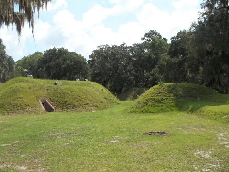
Fort McAllister is a Confederate earthwork fortification on the south bank of the Great Ogeechee River in Bryan County, Georgia. Begun in 1861, it was the southernmost of a series of works guarding Savannah from attack by sea and protecting nearby rice plantations and a railroad trestle. Its design is largely credited to Capt. John McCrady. Builders chose massive earthworks over masonry after the fall of Fort Pulaski. In 1863 Union ironclads, including the USS Montauk, bombarded the fort for hours, and the sand absorbed the shot. The fort fell in December 1864 to a rear assault in about 15 minutes of hand-to-hand fighting, witnessed by Gen. Sherman. Its capture opened supply contact with Union ships and ended the March to the Sea. Henry Ford began restoration in the 1930s. The property passed to the Georgia Historical Commission in 1958, which restored the earthworks and bombproofs and built a museum.
Significance in brief: The nomination calls it an outstanding example of Confederate earthwork fortification. It showed that earthen works could withstand the heaviest naval ordnance of the period. Its capture by Gen. Sherman in December 1864 let the Union Army get supplies from offshore vessels, ending the "March to the Sea."
Machine-generated summary. This summary was generated by a language model from the official nomination document and has not been reviewed line by line by an editor. It may contain errors. Check the source document before relying on any detail. Source: nomination document (PDF) · National Archives catalog entry. NRHP reference 70000197, listed May 13, 1970. Summary generated October 2026 (model claude-sonnet-5-5, prompt v1.0-2026-10-29, confidence high).
Key facts
| Address | 10 mi. E of Richmond Hill via GA 67, Richmond Hill |
|---|---|
| County | Bryan County |
| Listed | May 13, 1970 |
| Reference number | 70000197 |
| Resource type | Site |
| Period of significance | 1861-1864 |
| Architect / builder | Design largely attributed to Capt. John McCrady, a Confederate engineer, with some recommendations from Gen. Robert E. Lee |
| Areas of significance | Politics/Government, Architecture, Social History |
| Level of significance | National |
| Status (as stated in the nomination) | Listed as in excellent condition, unaltered and on its original site. It is state-owned, occupied, and open to visitors, with restored bombproofs, banquettes and parapets and a museum nearby. |
| Acreage | 30 |
| Coordinates | 31.89201, -81.19470 (NPS GIS) |
What listing means for this property
Sites (archaeological sites, battlefields, landscapes) are often listed with a restricted address to protect them from looting or disturbance. Listing is honorary for private owners; federal undertakings on or near the site go through Section 106 review, and state laws may protect burials and artefacts regardless of listing.
General information, not legal or tax advice. Rules change; confirm with your State Historic Preservation Office or a qualified adviser.
Sources and further reading
- National Park Service, National Register of Historic Places database (snapshot May 2026), reference 70000197.
- Nomination form (PDF, National Archives) — catalog entry
- Wikipedia article (used for cross-checking only; text not reproduced here)
- Wikidata Q8564756
- This listing as JSON
Last updated October 2026. Found an error? See the editorial policy for how to report it.