Lock and Dam No. 15 Historic District

The National Park Service has not published a boundary polygon for this district; the map shows the listed properties inside it and the district's reference point.
Why it's listed
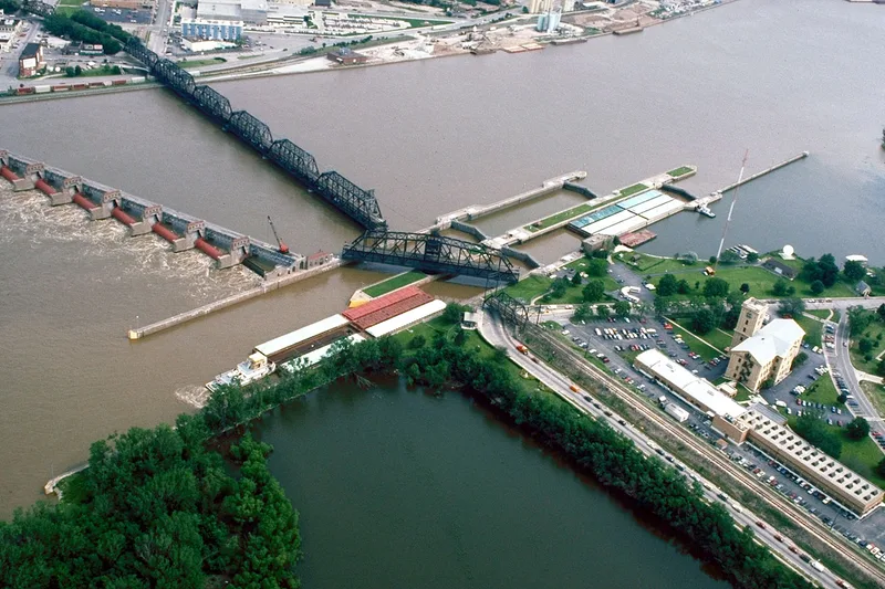
Lock and Dam No. 15 crosses the Upper Mississippi River at the foot of the Rock Island Rapids, linking Arsenal Island in Illinois with the Iowa shore. The 359-acre district contains two navigation locks, each with a 16-foot lift, a dam of eleven roller gates, a hydroelectric power house, a storage house, an Iowa-side seawall and intercepting sewer, and the double-deck Rock Island Arsenal Bridge. Contractors built most of the complex between 1931 and 1934, and it went into service on March 7, 1934. The bridge dates to 1895-1896 and its swing span pier is encased in the wall between the locks. The complex is unusual because it had a completed auxiliary lock, as only two other complexes in the project did. A major rehabilitation in 1993 resurfaced the structures and replaced much machinery in kind, but the district retains its location, design, setting, and overall character. It remains in continuous use as part of the 9-Foot Navigation Project.
Machine-generated summary. This summary was generated by a language model from the official nomination document and has not been reviewed line by line by an editor. It may contain errors. Check the source document before relying on any detail. Source: nomination document (PDF) · catalog entry. Generated October 2026 (model claude-sonnet-5-5, prompt v1.0-2026-10-29).
| Styles | OTHER: lock and dam; OTHER: Pratt truss; OTHER: Baltimore truss; OTHER: camelback trough-truss; NO STYLE: power house |
|---|---|
| Areas of significance | Transportation, Engineering, Maritime History, Social History, Commerce, Conservation, Economics, Military, Politics/Government |
| Acreage | 359 |
| Boundary source | not published |
| Full listing page | Lock and Dam No. 15 Historic District (property record) |
What listing means for this property
This is a historic district. Buildings within its boundary are either contributing (they add to the district's significance) or non-contributing. Owners of contributing income-producing buildings can claim the 20% federal rehabilitation tax credit; homeowners should look at state credits. National Register districts impose no design review by themselves; a local historic district ordinance, if one exists, does (the difference explained).
General information, not legal or tax advice. Rules change; confirm with your State Historic Preservation Office or a qualified adviser.