San Buenaventura Mission Aqueduct

Why it's listed
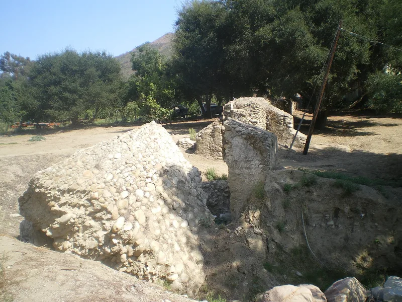
A short stretch of old stone viaduct on Canada Larga Road in Ventura is all that remains of the water system built for Mission San Buenaventura. Constructed between 1782 and 1794, the section is about 100 feet long and made of cobbles and mortar, once stuccoed. It stands about 12 feet high at the north end and falls to ground level at the south, with four heavy buttresses supporting the tall end. A tiled channel about two feet wide originally carried water along the top, but it has collapsed. Local Indian laborers built the aqueduct under the direction of Fr. Cambon, and it fed a settling basin, reservoirs and fountains used by the community and the mission's farming. Floods in the early 1860s ended its use, and later freeway construction and development erased the other sections. Because of this, it is regarded as probably the oldest man-made structure in Ventura County.
Significance in brief: The nomination argues these ruins are likely the oldest man-made structure in Ventura County and a heritage of Indian, Spanish and American pioneer cultures. The aqueduct supplied water for the mission's fountains, reservoirs and agriculture for more than 70 years. Freeway construction and development destroyed the rest of the system, leaving only this portion.
Machine-generated summary. This summary was generated by a language model from the official nomination document and has not been reviewed line by line by an editor. It may contain errors. Check the source document before relying on any detail. Source: nomination document (PDF) · National Archives catalog entry. NRHP reference 75000497, listed March 7, 1975. Summary generated October 2026 (model claude-sonnet-5-5, prompt v1.0-2026-10-29, confidence medium).
Key facts
| Address | 234 Canada Larga Rd., Ventura |
|---|---|
| County | Ventura County |
| Listed | March 7, 1975 |
| Reference number | 75000497 |
| Resource type | Structure |
| Period of significance | 18th Century; built 1782-1794, used until the 1860s |
| Architect / builder | Built under the supervision of Fr. Cambon, as assigned by Fr. Serra, with local Indian laborers |
| Areas of significance | Engineering |
| Level of significance | State |
| Status (as stated in the nomination) | Ruins in deteriorated condition; the top trough has collapsed, the structure is surrounded by lemon orchard and a house and garden, and preservation work is noted as in progress. |
| Acreage | 1 |
| Coordinates | 34.34203, -119.29061 (NPS GIS) |
What listing means for this property
National Register listing is honorary: it recognises significance and does not restrict what a private owner may do without federal money or permits. It unlocks the 20% federal rehabilitation tax credit for income-producing buildings, state credits in many states, and Section 106 review when federal agencies are involved. See what listing means in practice.
General information, not legal or tax advice. Rules change; confirm with your State Historic Preservation Office or a qualified adviser.
Sources and further reading
- National Park Service, National Register of Historic Places database (snapshot May 2026), reference 75000497.
- Nomination form (PDF, National Archives) — catalog entry
- Wikipedia article (used for cross-checking only; text not reproduced here)
- Wikidata Q7413493
- This listing as JSON
Last updated October 2026. Found an error? See the editorial policy for how to report it.