Mineral King Road Cultural Landscape
Also known as: Mineral King

Why it's listed
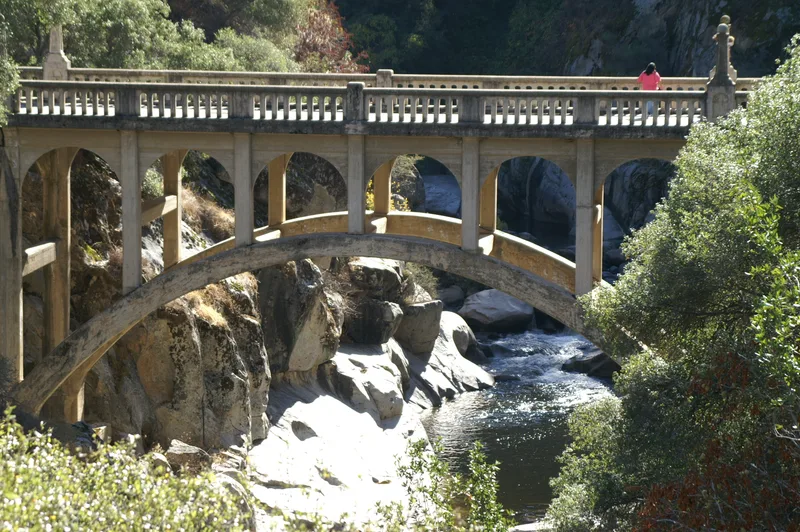
Mineral King Road and its three summer cabin tracts form a cultural landscape in Sequoia National Park, Tulare County, California. The road began in 1879 as a wagon route serving mining interests, then was improved for automobile traffic in the 1920s and 1930s, including work by the Civilian Conservation Corps. It runs about 24.8 miles from State Highway 198 to the Mineral King Valley. Along it lie Cabin Cove, West Mineral King (known as Faculty Flat) and East Mineral King, which together hold 66 rustic cabins, most built between 1915 and 1942 under Forest Service summer home permits following the Term Occupancy Act of 1915. The cabins are mostly rectangular, wood-sided with board-and-batten, and have stone chimneys. The district also includes CCC-built ranger structures and the Atwell Mill Ranger Residence of 1934. It was recognized for its link to early recreation development on federal land and for its rustic vernacular architecture. Logging and mining sites were left out for later study.
Significance in brief: The road and the cabin tracts are tied to the growth of outdoor recreation in the American West and to Forest Service recreation residence programs from 1915 to 1942. The road is also associated with 1930s Civilian Conservation Corps and National Park Service work. The cabin tracts are significant as intact examples of rustic vernacular recreation architecture.
Machine-generated summary. This summary was generated by a language model from the official nomination document and has not been reviewed line by line by an editor. It may contain errors. Check the source document before relying on any detail. Source: nomination document (PDF) · National Archives catalog entry. NRHP reference 03001063, listed October 24, 2003. Summary generated October 2026 (model claude-sonnet-5-5, prompt v1.0-2026-10-29, confidence medium).
Key facts
| Address | Mineral King Rd, Sequoia National Park, Mineral King |
|---|---|
| County | Tulare County |
| Listed | October 24, 2003 |
| Reference number | 03001063 |
| Resource type | District |
| Period of significance | 1915-1942 |
| Architect / builder | Civilian Conservation Corps labor (Lookout Point entrance station residence and garage); many cabins designed and built by permittees under Forest Service supervision |
| Architectural style | Historic vernacular; NPS Rustic |
| Criteria |
|
| Areas of significance | Entertainment/Recreation, Architecture, Transportation, Community Planning and Development |
| Level of significance | State |
| Status (as stated in the nomination) | The Atwell Mill Ranger Residence remains in use as a ranger residence. The Honeymoon Cabin was restored in the 1980s. The Mineral King Road still serves as a dead-end access road to the Mineral King Valley. |
| Acreage | 408 |
| Coordinates | 36.44915, -118.66355 (NPS GIS) |
What listing means for this property
This is a historic district. Buildings within its boundary are either contributing (they add to the district's significance) or non-contributing. Owners of contributing income-producing buildings can claim the 20% federal rehabilitation tax credit; homeowners should look at state credits. National Register districts impose no design review by themselves; a local historic district ordinance, if one exists, does (the difference explained).
General information, not legal or tax advice. Rules change; confirm with your State Historic Preservation Office or a qualified adviser.
Sources and further reading
- National Park Service, National Register of Historic Places database (snapshot May 2026), reference 03001063.
- Nomination form (PDF, National Archives) — catalog entry
- Wikidata Q99517501
- This listing as JSON
Last updated October 2026. Found an error? See the editorial policy for how to report it.