Petaluma Adobe
Also known as: Rancho Petaluma Adobe; Rancho Petaluma
Why it's listed
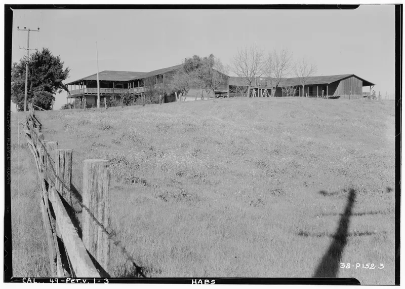
Rancho Petaluma Adobe, about four miles east of Petaluma in Sonoma County, served as the headquarters of a 67,000-acre rancho. Salvador Vallejo built it between 1835 and 1844 for his older brother, General Mariano Guadalupe Vallejo. The two-story Monterey Colonial house follows a U-shaped plan around three sides of a courtyard measuring 200 by 145 feet; a fourth wing was never fully completed. Its walls are three feet thick and 20 feet high, set on native field stone foundations. A broad two-story veranda ran around the interior and exterior, and iron grills and wooden shutters covered the openings. Living quarters were on the upper floor, with storerooms and workshops below. Redwood timbers were hauled by oxen from forests about 50 miles north, and Indian laborers made the adobe bricks on site. It is described as the largest surviving adobe structure in California. After falling into poor repair by 1910, it became a state historical monument in 1951 and has since been restored as a state park museum.
Significance in brief: The nomination calls it the largest existing adobe structure in California. It is a notable example of Monterey Colonial architecture and a surviving centre of the Spanish and Mexican-era cattle rancho economy. It was recommended as nationally significant within the Colonial Architecture and Spanish Exploration and Settlement themes.
Machine-generated summary. This summary was generated by a language model from the official nomination document and has not been reviewed line by line by an editor. It may contain errors. Check the source document before relying on any detail. Source: nomination document (PDF) · National Archives catalog entry. NRHP reference 70000151, listed April 15, 1970. Summary generated October 2026 (model claude-sonnet-5-5, prompt v1.0-2026-10-29, confidence medium).
Key facts
| Address | 4 mi. E of Petaluma on Casa Grande Rd., Petaluma |
|---|---|
| County | Sonoma County |
| Listed | April 15, 1970 |
| Reference number | 70000151 |
| Resource type | Building |
| Architect / builder | Salvador Vallejo, built for General Mariano Guadalupe Vallejo |
| Architectural style | Monterey Colonial |
| Areas of significance | Agriculture, Exploration/Settlement, Architecture |
| Level of significance | National |
| National Historic Landmark | Yes, designated April 15, 1970 |
| Status (as stated in the nomination) | Restored and in excellent condition; used as a state park. It became a California State Historical Monument in 1951 and was being repaired and reconstructed. |
| Acreage | 5 |
| Coordinates | 38.25619, -122.58483 (NPS GIS) |
What listing means for this property
National Register listing is honorary: it recognises significance and does not restrict what a private owner may do without federal money or permits. It unlocks the 20% federal rehabilitation tax credit for income-producing buildings, state credits in many states, and Section 106 review when federal agencies are involved. See what listing means in practice.
General information, not legal or tax advice. Rules change; confirm with your State Historic Preservation Office or a qualified adviser.
Sources and further reading
- National Park Service, National Register of Historic Places database (snapshot May 2026), reference 70000151.
- Nomination form (PDF, National Archives) — catalog entry
- Wikipedia article (used for cross-checking only; text not reproduced here)
- Wikidata Q7291163
- This listing as JSON
Last updated October 2026. Found an error? See the editorial policy for how to report it.