Lower Klamath National Wildlife Refuge

Why it's listed
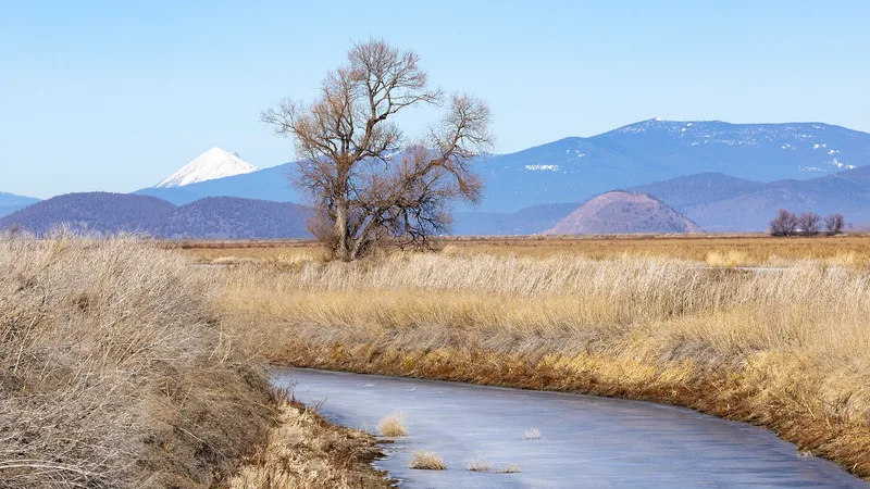
Lower Klamath National Wildlife Refuge covers wetlands, fields and uplands on both sides of the California-Oregon border near Dorris. Established by executive order in 1908, it was the first of six refuges in the Klamath Basin complex. The basin once held roughly 187,000 acres of marsh that drew millions of migrating waterfowl. After 1917, federal reclamation cut off the lake's water supply, and by the early 1920s only about 1,000 acres of open water remained. When the alkaline lakebed proved unsuitable for farming, the effort was abandoned. Beginning around 1940, agencies built dikes, canals, pumping plants and a 6,600-foot tunnel from Tule Lake to restore habitat; the basic system was working by 1949. These structures, along with the refuge management units, are counted as contributing resources. Thirty-six archeological sites, dating from about 5,000 B.C., lie within the boundaries but are counted separately. The Kuchel Act of 1964 set permanent boundaries and put wildlife needs ahead of reclamation.
Significance in brief: The refuge was the first of the Klamath Basin refuges and is tied to the theme of conservation of natural resources. Waterfowl habitat was restored after reclamation drained the lakebed, using a system of dikes, canals, pumping plants and a tunnel built mostly from 1940 to 1949. The Kuchel Act of 1964 later gave wildlife needs priority over reclamation within the refuge.
Machine-generated summary. This summary was generated by a language model from the official nomination document and has not been reviewed line by line by an editor. It may contain errors. Check the source document before relying on any detail. Source: nomination document (PDF) · National Archives catalog entry. NRHP reference 66000238, listed October 15, 1966. Summary generated October 2026 (model claude-sonnet-5-5, prompt v1.0-2026-10-29, confidence medium).
Key facts
| Address | Lower Klamath Lake, E of Dorris, Dorris |
|---|---|
| County | Siskiyou County |
| Listed | October 15, 1966 |
| Reference number | 66000238 |
| Resource type | Site |
| Architect / builder | U.S. Fish and Wildlife Service, U.S. Bureau of Reclamation, and Klamath Drainage District (builders of the water control structures) |
| Architectural style | No style |
| Areas of significance | Conservation |
| Level of significance | National |
| National Historic Landmark | Yes, designated January 12, 1965 |
| Status (as stated in the nomination) | Functions as an active wildlife refuge and conservation area; water levels are managed through dikes, canals and pumps, and some lands are share-cropped or leased. |
| Acreage | 28000 |
| Coordinates | 41.95458, -121.68768 (NPS GIS) |
What listing means for this property
Sites (archaeological sites, battlefields, landscapes) are often listed with a restricted address to protect them from looting or disturbance. Listing is honorary for private owners; federal undertakings on or near the site go through Section 106 review, and state laws may protect burials and artefacts regardless of listing.
General information, not legal or tax advice. Rules change; confirm with your State Historic Preservation Office or a qualified adviser.
Sources and further reading
- National Park Service, National Register of Historic Places database (snapshot May 2026), reference 66000238.
- Nomination form (PDF, National Archives) — catalog entry
- Wikipedia article (used for cross-checking only; text not reproduced here)
- Wikidata Q3423293
- This listing as JSON
Last updated October 2026. Found an error? See the editorial policy for how to report it.