Captain Jack's Stronghold

Why it's listed
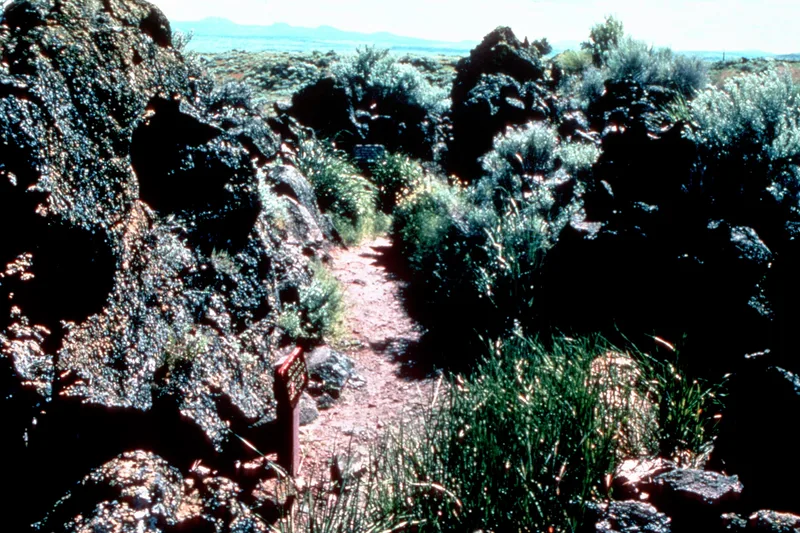
Captain Jack's Stronghold is a stretch of twisted, contorted lava on the south shore of the former Tule Lake, now inside Lava Beds National Monument in Siskiyou County, California. In 1872-73 the Modoc people used its rock formations, cracks in the frozen lava and natural caves as a defensive position, adding breastworks and small rock fortifications. Army troops built their own rock fortifications during two major attacks and added more after occupying the site. About 130 fortifications have been marked so far, along with features such as the cave said to have sheltered Captain Jack's family, a war dance circle, a council ground and horse and cattle corrals. Roughly 70 Modoc men held out for five and a half months against far larger forces, repulsing an attack by 300 troops in January 1873 and withdrawing successfully after inflicting severe casualties on 650 troops in April. The site is regarded as symbolizing the Modoc War and the tribe's last major stand.
Significance in brief: About 70 Modoc men held the Stronghold for five and a half months against a much larger force of U.S. soldiers and volunteers. They repelled the first attack in January 1873 and withdrew successfully after inflicting heavy casualties in the April 1873 assault. The nomination presents it as the symbol of the Modoc War and the tribe's last major stand, and calls it nationally significant.
Machine-generated summary. This summary was generated by a language model from the official nomination document and has not been reviewed line by line by an editor. It may contain errors. Check the source document before relying on any detail. Source: nomination document (PDF) · National Archives catalog entry. NRHP reference 73000259, listed September 20, 1973. Summary generated October 2026 (model claude-sonnet-5-5, prompt v1.0-2026-10-29, confidence medium).
Key facts
| Address | S of Tulelake, Lava Beds National Monument, Tulelake |
|---|---|
| County | Siskiyou County |
| Listed | September 20, 1973 |
| Reference number | 73000259 |
| Resource type | District |
| Period of significance | 1872-73 |
| Areas of significance | Native American, Military |
| Level of significance | National |
| Status (as stated in the nomination) | Listed in excellent condition, altered, on its original site; owned by the National Park Service and described as unoccupied, with unrestricted public access. |
| Acreage | 460 |
| Coordinates | 41.82151, -121.50616 (NPS GIS) |
What listing means for this property
This is a historic district. Buildings within its boundary are either contributing (they add to the district's significance) or non-contributing. Owners of contributing income-producing buildings can claim the 20% federal rehabilitation tax credit; homeowners should look at state credits. National Register districts impose no design review by themselves; a local historic district ordinance, if one exists, does (the difference explained).
Noted as vacant in the nomination. Nomination documents can be decades old; current status may differ. If you are considering buying an empty listed property, read the due-diligence checklist.
General information, not legal or tax advice. Rules change; confirm with your State Historic Preservation Office or a qualified adviser.
Sources and further reading
- National Park Service, National Register of Historic Places database (snapshot May 2026), reference 73000259.
- Nomination form (PDF, National Archives) — catalog entry
- Wikipedia article (used for cross-checking only; text not reproduced here)
- Wikidata Q5036678
- This listing as JSON
Last updated October 2026. Found an error? See the editorial policy for how to report it.