Nobles Emigrant Trail
Also known as: Fort Kearney; South Pass; Honey Lake Wagon Road
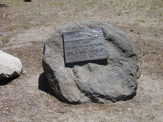

Why it's listed
Crossing about twenty-four miles of what is now Lassen Volcanic National Park, Nobles' Emigrant Trail survives as a narrow, overgrown path through trees and brush. Officially the Fort Kearney, South Pass and Honey Lake Wagon Road, it was blazed by William Nobles, a Minnesota blacksmith and wagon builder who found the route in 1851 after joining a search for a legendary Gold Lake with Peter Lassen. His route cut roughly half the distance of the Applegate-Lassen trails. Nobles promoted it to Shasta businessmen, who paid him to show the way, and later lobbied Congress, which appropriated $300,000 for improvements. The road served emigrants heading to California until the Central Pacific Railroad was completed in 1869. Its promotion was largely commercial, meant to bring traffic and trade to Shasta and the northern Central Valley. A mudflow from the 1915 Lassen Peak eruption destroyed about a mile and a half of it. Listing recognizes its regional significance in transportation, commerce and communications.
Significance in brief: The trail was a shortcut variant of the California Trail, blazed and promoted by William Nobles in 1851-52. It cut about half the distance of the Applegate-Lassen route and carried emigrants to California until the Central Pacific Railroad was completed in 1869. The form rates it as regionally, not nationally, significant in transportation, commerce and communications.
Machine-generated summary. This summary was generated by a language model from the official nomination document and has not been reviewed line by line by an editor. It may contain errors. Check the source document before relying on any detail. Source: nomination document (PDF) · National Archives catalog entry. NRHP reference 75000222, listed October 3, 1975. Summary generated October 2026 (model claude-sonnet-5-5, prompt v1.0-2026-10-29, confidence medium).
Key facts
| Address | E of Shingletown in Lassen Volcanic National Park, Shingletown |
|---|---|
| County | Shasta County |
| Listed | October 3, 1975 |
| Reference number | 75000222 |
| Resource type | District |
| Period of significance | 19th Century |
| Areas of significance | Commerce, Transportation, Communications |
| Level of significance | State |
| Status (as stated in the nomination) | Condition marked good and altered; the trail is generally visible as a narrow, overgrown path through trees and brush. No historic structures are associated with it, and part is suitable for hiking. About 1.5 miles were destroyed by the 1915 Lassen Peak mudflow. |
| Acreage | 582 |
| Coordinates | 40.55257, -121.36788 (NPS GIS) |
What listing means for this property
This is a historic district. Buildings within its boundary are either contributing (they add to the district's significance) or non-contributing. Owners of contributing income-producing buildings can claim the 20% federal rehabilitation tax credit; homeowners should look at state credits. National Register districts impose no design review by themselves; a local historic district ordinance, if one exists, does (the difference explained).
General information, not legal or tax advice. Rules change; confirm with your State Historic Preservation Office or a qualified adviser.
Sources and further reading
- National Park Service, National Register of Historic Places database (snapshot May 2026), reference 75000222.
- Nomination form (PDF, National Archives) — catalog entry
- Wikipedia article (used for cross-checking only; text not reproduced here)
- Wikidata Q7045838
- This listing as JSON
Last updated October 2026. Found an error? See the editorial policy for how to report it.