Lassen Volcanic National Park Highway Historic District
Also known as: NPS Route 1; Lassen Loop Highway; Lassen Peak Highway; State Route 89

Why it's listed
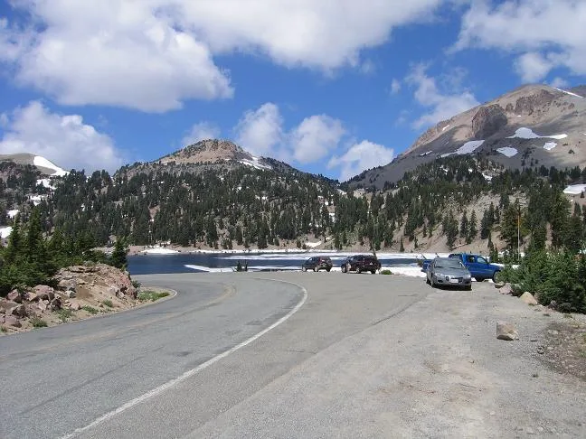
Lassen Volcanic National Park Highway is a 29.86-mile road linking the park's southwest and northwest entrances. It climbs from 6,646 feet to 8,511 feet near Lassen Peak, then descends toward Manzanita Lake, crossing geothermal areas, subalpine forests, meadows and lava fields. National Park Service engineers laid out the alignment in 1924-25 to show automobile tourists the park's most scenic and geologically interesting places, and the Bureau of Public Roads took over much of the construction after a 1926 agreement. Civilian Conservation Corps projects continued until 1941, and paving and widening followed between 1948 and 1951. Scenic pullouts, masonry culvert headwalls, bridge culverts, entrance pylons and the northwest entrance station were built from native materials to blend with the surroundings. Grades never exceed six percent. The road is listed as an intact early example of national park road design, and it remains the main way visitors experience the park.
Significance in brief: The nomination argues the highway is an intact example of early National Park Service road design. Its alignment, overlooks, culvert headwalls, bridge culverts, entrance pylons and northwest entrance station use native materials and naturalistic design to blend with the volcanic landscape. It reflects major construction by the National Park Service, the Bureau of Public Roads and the Civilian Conservation Corps.
Machine-generated summary. This summary was generated by a language model from the official nomination document and has not been reviewed line by line by an editor. It may contain errors. Check the source document before relying on any detail. Source: nomination document (PDF) · National Archives catalog entry. NRHP reference 06000527, listed June 23, 2006. Summary generated October 2026 (model claude-sonnet-5-5, prompt v1.0-2026-10-29, confidence medium).
Key facts
| Address | NPS Route 1, CA 89, Mineral |
|---|---|
| County | Shasta County |
| Listed | June 23, 2006 |
| Reference number | 06000527 |
| Resource type | District |
| Period of significance | 1925-1941 and 1948-1951 |
| Architect / builder | National Park Service engineers and landscape architects; Bureau of Public Roads |
| Architectural style | Other: NPS Rustic |
| Areas of significance | Entertainment/Recreation, Architecture, Landscape Architecture, Community Planning and Development |
| Level of significance | State, Local |
| Status (as stated in the nomination) | Still used as the primary touring route through the park; closed by snow from late October through mid-June. |
| Acreage | 290 |
| Coordinates | 40.51826, -121.51414 (NPS GIS) |
What listing means for this property
This is a historic district. Buildings within its boundary are either contributing (they add to the district's significance) or non-contributing. Owners of contributing income-producing buildings can claim the 20% federal rehabilitation tax credit; homeowners should look at state credits. National Register districts impose no design review by themselves; a local historic district ordinance, if one exists, does (the difference explained).
General information, not legal or tax advice. Rules change; confirm with your State Historic Preservation Office or a qualified adviser.
Sources and further reading
- National Park Service, National Register of Historic Places database (snapshot May 2026), reference 06000527.
- Nomination form (PDF, National Archives) — catalog entry
- Wikipedia article (used for cross-checking only; text not reproduced here)
- Wikidata Q6493975
- This listing as JSON
Last updated October 2026. Found an error? See the editorial policy for how to report it.