Farallone Islands
Also known as: Los Farallones; South Farallons; Southeast Farallon

Why it's listed
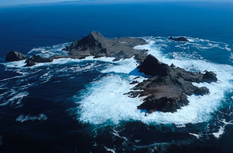
Rising from the Pacific about 28 miles west of San Francisco, the Farallon Islands are steep volcanic rocks totaling roughly 120 acres, with the main island of Southeast Farallon about 70 acres. Juan Rodriguez Cabrillo landed in 1539, and Sir Francis Drake stopped in 1579 to gather sea lion and bird meat for his crew. In the 1800s the islands were stripped of fur seals and sea otters by New England, Russian and Mexican hunters, and egg companies collected millions of murre eggs to feed Gold Rush San Francisco, sometimes in violent disputes. The government completed a lighthouse in 1855, first lit in 1856, with a fog signal designed by Major Hartman Bache. Coast Guard staff left when it was automated in 1972. Protected as a wildlife refuge since 1909, the islands again hold the largest sea bird rookery south of Alaska and remain close to their primitive condition.
Significance in brief: The islands have a recorded history longer than that of the mainland of San Francisco and were long valued for their abundant marine wildlife. They were visited by Cabrillo and Drake, exploited for fur seals, sea otters and sea bird eggs in the 19th century, and later protected as a wildlife refuge. The lighthouse of 1855 and its fog signal add to their importance for commerce and navigation.
Machine-generated summary. This summary was generated by a language model from the official nomination document and has not been reviewed line by line by an editor. It may contain errors. Check the source document before relying on any detail. Source: nomination document (PDF) · National Archives catalog entry. NRHP reference 77000332, listed March 8, 1977. Summary generated October 2026 (model claude-sonnet-5-5, prompt v1.0-2026-10-29, confidence medium).
Key facts
| Address | 28 mi. W of San Francisco, San Francisco |
|---|---|
| County | San Francisco |
| Listed | March 8, 1977 |
| Reference number | 77000332 |
| Resource type | Site |
| Period of significance | 1500-1999 |
| Architect / builder | Fog signal designed by Major Hartman Bache of the U.S. Engineers |
| Areas of significance | Commerce, Exploration/Settlement |
| Level of significance | National |
| Status (as stated in the nomination) | Lighthouse automated in 1972 and run by remote control; a minimum of two biologists live on the island to protect and study wildlife. Form marks status as occupied. |
| Acreage | 211 |
| Coordinates | 37.74576, -123.08445 (NPS GIS) |
What listing means for this property
Sites (archaeological sites, battlefields, landscapes) are often listed with a restricted address to protect them from looting or disturbance. Listing is honorary for private owners; federal undertakings on or near the site go through Section 106 review, and state laws may protect burials and artefacts regardless of listing.
General information, not legal or tax advice. Rules change; confirm with your State Historic Preservation Office or a qualified adviser.
Sources and further reading
- National Park Service, National Register of Historic Places database (snapshot May 2026), reference 77000332.
- Nomination form (PDF, National Archives) — catalog entry
- Wikipedia article (used for cross-checking only; text not reproduced here)
- Wikidata Q1396187
- This listing as JSON
Last updated October 2026. Found an error? See the editorial policy for how to report it.