Pioneer Deep Space Station

Why it's listed
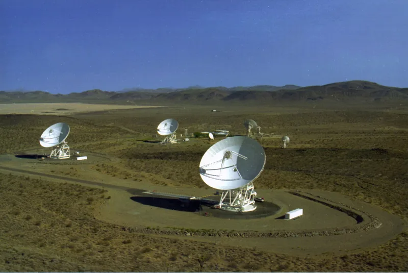
Built in 1958 in the Mojave Desert at Fort Irwin, about 45 miles northwest of Barstow, this 26-meter steerable dish was the first deep space tracking station in NASA's Deep Space Network. The dish, made of punched aluminum panels on a steel framework, sits atop a 62-foot polar mount that follows objects from horizon to horizon. Construction began as an Army project under the Jet Propulsion Laboratory before NASA was created. The site was chosen for its natural bowl shape and distance from electrical and broadcast interference. The antenna served as the prototype for later stations, and it tracked missions such as Pioneer, Ranger, Surveyor, Apollo, Mariner, Viking and Voyager. Features developed here were later used in the 64-meter antennas that follow spacecraft to the edge of the solar system. It is now mothballed and technologically obsolete. NASA dedicated a plaque to the station in 1978. The nominated boundary covers only the antenna and its base.
Significance in brief: It was the first antenna to support NASA's unmanned exploration of deep space and the prototype for the whole Deep Space Network. Design features proven here were carried into later, larger antennas. During its working life it tracked missions including Pioneer, Echo, Ranger, Lunar Orbiter, Surveyor, Apollo, Helios, Mariner, Viking and Voyager.
Machine-generated summary. This summary was generated by a language model from the official nomination document and has not been reviewed line by line by an editor. It may contain errors. Check the source document before relying on any detail. Source: nomination document (PDF) · National Archives catalog entry. NRHP reference 85002813, listed October 3, 1985. Summary generated October 2026 (model claude-sonnet-5-5, prompt v1.0-2026-10-29, confidence high).
Key facts
| Address | Goldstone Deep Space Communications Complex, Fort Irwin |
|---|---|
| County | San Bernardino County |
| Listed | October 3, 1985 |
| Reference number | 85002813 |
| Resource type | Structure |
| Period of significance | 1958-1978 |
| Architect / builder | U.S. Army |
| Areas of significance | Other, Engineering, Communications |
| Level of significance | National |
| National Historic Landmark | Yes, designated October 3, 1985 |
| Status (as stated in the nomination) | Mothballed and in standby status; technologically obsolete, with other NASA tracking stations now handling active space probes. Condition listed as excellent and unaltered. |
| Acreage | 0.9 |
| Coordinates | 35.38949, -116.84949 (NPS GIS) |
What listing means for this property
For an income-producing building, listing (individually or as a contributing building in a district) is the gateway to the 20% federal rehabilitation tax credit on qualified rehabilitation costs, often stackable with state credits. Work claiming the credit must follow the Secretary of the Interior's Standards and be approved in advance.
Listing does not restrict a private owner acting without federal money or permits; where federal funding or licensing is involved, Section 106 review applies.
General information, not legal or tax advice. Rules change; confirm with your State Historic Preservation Office or a qualified adviser.
Sources and further reading
- National Park Service, National Register of Historic Places database (snapshot May 2026), reference 85002813.
- Nomination form (PDF, National Archives) — catalog entry
- Wikipedia article (used for cross-checking only; text not reproduced here)
- Wikidata Q618630
- This listing as JSON
Last updated October 2026. Found an error? See the editorial policy for how to report it.