Mill Creek Zanja
Also known as: The Sankey; Zanja

Why it's listed
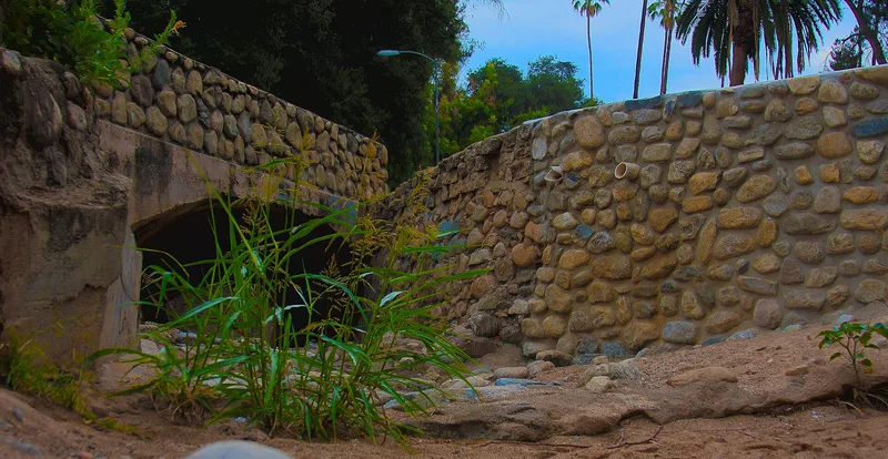
Mill Creek Zanja is a six-mile ditch that carries water from an intake weir box in Mentone southwest through Crafton to Sylvan Park in Redlands. Franciscan fathers from Mission San Gabriel began planning it in 1819 to teach farming to the Gauchama Indians. Pedro Alvarez laid out the route, and Gauchama workers under their chief, Solano, did the digging. It was finished in time for spring planting in 1820. The route follows natural draws and depressions, with excavation where the ground rose. The ditch later served Mexican-era colonists and early American settlers, and for years it was the only water supply in early Redlands. Its water rights prompted twelve major lawsuits, including one in 1876 that held the Zanja to be a man-made stream. The nomination describes it as the oldest civil engineering project in Southern California and a California Historical Landmark. Parts still flow, and many trees planted along its banks survive. A flood-control channel has altered a short stretch near Lincoln Street.
Significance in brief: The nomination calls the Zanja the oldest civil engineering project in Southern California and the oldest irrigation ditch in the county. It supplied food for the Gauchama Indians, served Mexican-era and early American settlers, and shaped settlement patterns in Redlands, Crafton and Mentone. It is also California State Historical Landmark No. 43.
Machine-generated summary. This summary was generated by a language model from the official nomination document and has not been reviewed line by line by an editor. It may contain errors. Check the source document before relying on any detail. Source: nomination document (PDF) · National Archives catalog entry. NRHP reference 77000329, listed May 12, 1977. Summary generated October 2026 (model claude-sonnet-5-5, prompt v1.0-2026-10-29, confidence medium).
Key facts
| Address | Sylvan Blvd. E to Mill Creek Rd., Redlands and |
|---|---|
| County | San Bernardino County |
| Listed | May 12, 1977 |
| Reference number | 77000329 |
| Resource type | District |
| Period of significance | 1819-1920 |
| Architect / builder | Pedro Alvarez, and Gauchama Indians |
| Areas of significance | Agriculture, Engineering, Social History |
| Level of significance | Local |
| Status (as stated in the nomination) | Still partly in use: water runs in the eastern two miles and waste water or storm water flows through most of it. About 0.3 to 0.4 mile near Lincoln Street was altered by a new County Flood Control channel. The nominated six miles are mostly in their original location. |
| Acreage | 15 |
| Coordinates | 34.06729, -117.09845 (NPS GIS) |
What listing means for this property
This is a historic district. Buildings within its boundary are either contributing (they add to the district's significance) or non-contributing. Owners of contributing income-producing buildings can claim the 20% federal rehabilitation tax credit; homeowners should look at state credits. National Register districts impose no design review by themselves; a local historic district ordinance, if one exists, does (the difference explained).
General information, not legal or tax advice. Rules change; confirm with your State Historic Preservation Office or a qualified adviser.
Sources and further reading
- National Park Service, National Register of Historic Places database (snapshot May 2026), reference 77000329.
- Nomination form (PDF, National Archives) — catalog entry
- Wikipedia article (used for cross-checking only; text not reproduced here)
- Wikidata Q20714656
- This listing as JSON
Last updated October 2026. Found an error? See the editorial policy for how to report it.