Boulevard Park
Also known as: Union Park

Why it's listed
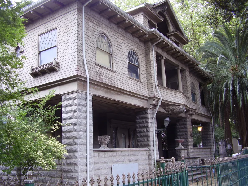
Boulevard Park is a planned residential neighborhood in Sacramento's original city grid, laid out on 37.5 acres bought by the Park Realty Company in 1905. It spans 15 blocks between B and H Streets. Twenty-three landscaped median strips planted with palms run along 21st and 22nd Streets and give the area its name. Three private alley parks sit in the centers of blocks, and Grant Park occupies a block on the north edge. Deed covenants controlled setbacks, uses and minimum house prices, and the largest lots and most elaborate houses are in the southern blocks nearest the streetcar line. Most of the 244 contributing resources are houses built between 1905 and 1946, including Craftsman and California bungalows, foursquares and Neoclassic row houses. The district was listed because its landscape plan, covenant-controlled layout and consistent scale and setback remain intact, while newer apartment buildings account for most of the 54 noncontributing resources.
Significance in brief: The district is described as a planned streetcar-era suburb with landscaped boulevards, alley parks and deed covenants that set setbacks and uses. Its eclectic early-20th-century houses form a uniform streetscape and retain a high degree of integrity. The form also notes that 21st and 22nd Streets were the first landscaped boulevards in Sacramento, a feature of "City Beautiful" neighborhoods.
Machine-generated summary. This summary was generated by a language model from the official nomination document and has not been reviewed line by line by an editor. It may contain errors. Check the source document before relying on any detail. Source: nomination document (PDF) · National Archives catalog entry. NRHP reference 11000705, listed October 3, 2011. Summary generated October 2026 (model claude-sonnet-5-5, prompt v1.0-2026-10-29, confidence medium).
Key facts
| Address | Roughly bounded by B and H Streets, 20th Street, 22nd Street & 23rd Street, Sacramento |
|---|---|
| County | Sacramento County |
| Listed | October 3, 2011 |
| Reference number | 11000705 |
| Resource type | District |
| Period of significance | 1905-1946 |
| Architect / builder | Wright & Kimbrough (builders and sellers of standard house patterns); Park Realty Company (developer) |
| Architectural style | Classical Revival, Colonial Revival, Craftsman, Spanish Colonial Revival, Tudor Revival, Prairie |
| Areas of significance | Architecture, Community Planning and Development |
| Level of significance | Local |
| Status (as stated in the nomination) | Largely residential and still in use, with a city park, private alley parks and a half-block of light industrial use. Some single-family houses have been converted to duplexes or apartments. |
| Coordinates | 38.58284, -115.47735 (NPS GIS) |
What listing means for this property
This is a historic district. Buildings within its boundary are either contributing (they add to the district's significance) or non-contributing. Owners of contributing income-producing buildings can claim the 20% federal rehabilitation tax credit; homeowners should look at state credits. National Register districts impose no design review by themselves; a local historic district ordinance, if one exists, does (the difference explained).
General information, not legal or tax advice. Rules change; confirm with your State Historic Preservation Office or a qualified adviser.
Sources and further reading
- National Park Service, National Register of Historic Places database (snapshot May 2026), reference 11000705.
- Nomination form (PDF, National Archives) — catalog entry
- Wikipedia article (used for cross-checking only; text not reproduced here)
- Wikidata Q4949659
- This listing as JSON
Last updated October 2026. Found an error? See the editorial policy for how to report it.