Ryan House and Lost Horse Well
Also known as: Ryan Well

Why it's listed
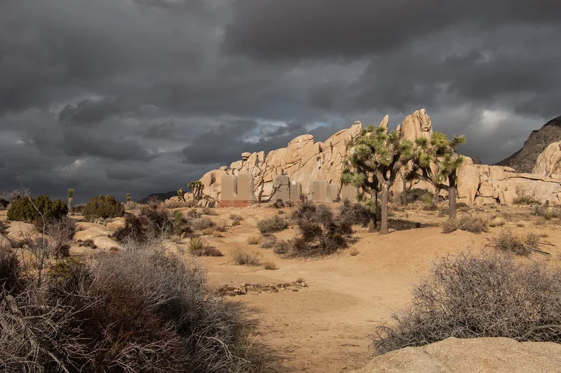
Set near the southwestern base of Ryan Mountain in what is now Joshua Tree National Monument, this ranch complex includes an adobe house of roughly 30 by 40 feet, two smaller adobe buildings, a 70-foot-deep well with a windmill and pump, a graveyard of about ten graves, and the scant remains of a boulder corral. The Ryan family, led by brothers Tom and Jepp, arrived in the 1890s and, according to local tradition, raised the adobe residence during that decade. They took over the Lost Horse Mine in 1896, built a ten-stamp mill there, and piped water from Lost Horse Spring to the mine about three miles away. A well dug in 1905 changed the spring's name to Lost Horse Well. The site is valued as a surviving example of desert mining life and of the early, successful mining of the area. Weathering has worn the adobe, and one small building is close to ruin.
Significance in brief: The complex was the home base of the Ryan family, later developers of the Lost Horse Mine, the most profitable mine in the area. Its spring and later well supplied water by pump and pipe to the mine about three miles away. It is presented as showing the way of life of early desert miners.
Machine-generated summary. This summary was generated by a language model from the official nomination document and has not been reviewed line by line by an editor. It may contain errors. Check the source document before relying on any detail. Source: nomination document (PDF) · National Archives catalog entry. NRHP reference 75000175, listed June 5, 1975. Summary generated October 2026 (model claude-sonnet-5-5, prompt v1.0-2026-10-29, confidence medium).
Key facts
| Address | S of Twentynine Palms in Joshua Tree National Monument, Twentynine Palms |
|---|---|
| County | Riverside County |
| Listed | June 5, 1975 |
| Reference number | 75000175 |
| Resource type | District |
| Period of significance | 1890s |
| Architect / builder | Tom and Jepp Ryan |
| Areas of significance | Industry, Engineering |
| Level of significance | Local |
| Status (as stated in the nomination) | Condition rated fair and unaltered, on its original site. The smaller adobe is decaying toward ruins, while the larger adobe appears still in use. Emergency stabilization was estimated at $9,000. |
| Acreage | 16 |
| Coordinates | 33.98500, -116.14862 (NPS GIS) |
What listing means for this property
This is a historic district. Buildings within its boundary are either contributing (they add to the district's significance) or non-contributing. Owners of contributing income-producing buildings can claim the 20% federal rehabilitation tax credit; homeowners should look at state credits. National Register districts impose no design review by themselves; a local historic district ordinance, if one exists, does (the difference explained).
General information, not legal or tax advice. Rules change; confirm with your State Historic Preservation Office or a qualified adviser.
Sources and further reading
- National Park Service, National Register of Historic Places database (snapshot May 2026), reference 75000175.
- Nomination form (PDF, National Archives) — catalog entry
- Wikipedia article (used for cross-checking only; text not reproduced here)
- Wikidata Q7384157
- This listing as JSON
Last updated October 2026. Found an error? See the editorial policy for how to report it.