Desert Queen Mine

Why it's listed
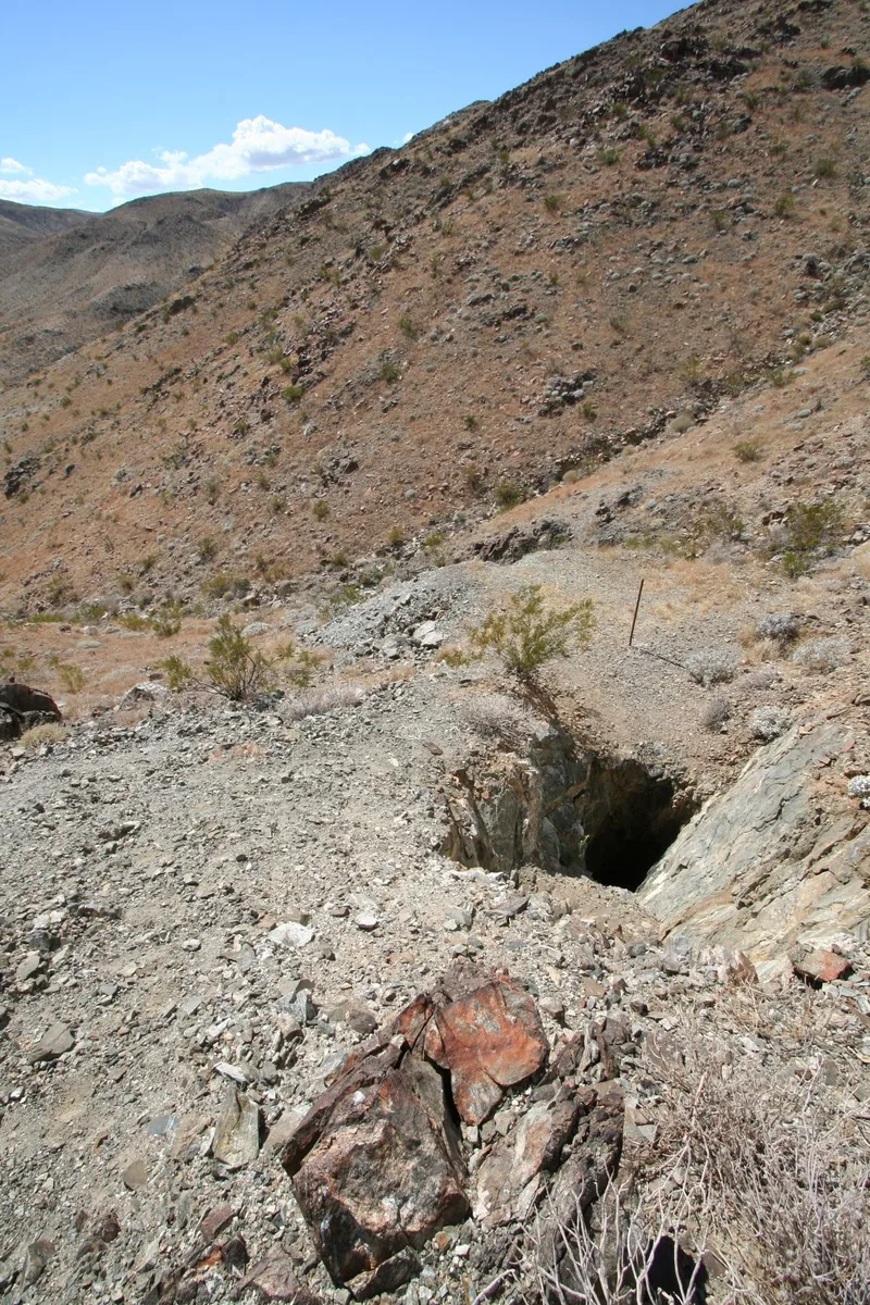
Desert Queen Mine is an abandoned gold mine of roughly 80 acres in Joshua Tree National Monument, south of Twentynine Palms. Its remains include four large vertical shafts, five inclined shafts, ten adits, and a main tailings pile 65 feet high. Scattered across the site are pipe, cyanide tanks, tramway track, concrete pads, an air pump marked Chicago Pneumatic, and the ruins of a stone house on the opposite hillside. The mine was listed as a locally significant example of desert mining. A. James discovered the gold in the early 1890s and was killed after being forced to sign the mine over to cattle rustler Jim McHaney. McHaney borrowed against expected ore, and the mine passed to a bank. William F. Keys possibly acquired it in 1917 and worked it intermittently until 1961. Operation was sporadic, yet occasional rich pockets of ore sustained interest for decades, making it more productive and longer-lived than most neighboring mines.
Significance in brief: The nomination argues the mine has local significance in the history of mining as one of the more successful and longer-lived mines of Southern California's high desert. It was worked sporadically for nearly three quarters of a century and was linked to a notorious local outlaw. Its tunnels, inclined shafts and vertical shafts represent three basic mine approaches typical of southwestern desert mines.
Machine-generated summary. This summary was generated by a language model from the official nomination document and has not been reviewed line by line by an editor. It may contain errors. Check the source document before relying on any detail. Source: nomination document (PDF) · National Archives catalog entry. NRHP reference 76000216, listed January 17, 1976. Summary generated October 2026 (model claude-sonnet-5-5, prompt v1.0-2026-10-29, confidence medium).
Key facts
| Address | S of Twentynine Palms in Joshua Tree National Monument, Twentynine Palms |
|---|---|
| County | Riverside County |
| Listed | January 17, 1976 |
| Reference number | 76000216 |
| Resource type | District |
| Period of significance | 1894 - 1961 |
| Architect / builder | A. James, J. McHaney, W.F. Keys |
| Areas of significance | Industry |
| Level of significance | Local |
| Status (as stated in the nomination) | Described as in ruins and deteriorated, with collapsed or sealed adits, scattered equipment and a ruined stone house; sealing of shafts and tunnels may be needed for visitor safety. |
| Acreage | 80 |
| Coordinates | 34.02389, -116.06989 (NPS GIS) |
What listing means for this property
This is a historic district. Buildings within its boundary are either contributing (they add to the district's significance) or non-contributing. Owners of contributing income-producing buildings can claim the 20% federal rehabilitation tax credit; homeowners should look at state credits. National Register districts impose no design review by themselves; a local historic district ordinance, if one exists, does (the difference explained).
General information, not legal or tax advice. Rules change; confirm with your State Historic Preservation Office or a qualified adviser.
Sources and further reading
- National Park Service, National Register of Historic Places database (snapshot May 2026), reference 76000216.
- Nomination form (PDF, National Archives) — catalog entry
- Wikipedia article (used for cross-checking only; text not reproduced here)
- Wikidata Q5264000
- This listing as JSON
Last updated October 2026. Found an error? See the editorial policy for how to report it.