Serrano, Jose, Adobe
Also known as: Serrano Adobe

Why it's listed
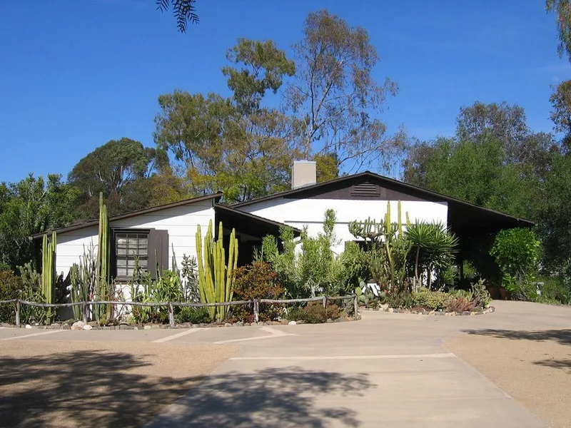
Built around 1856-1860 on a low hill near Serrano Creek, this U-shaped adobe in El Toro was the home of rancher Jose Serrano, whose Rancho Canada de los Alisos covered more than 10,000 acres. Its walls are 21-22 inches thick. Serrano and his sons built five adobes on the rancho, and this is the only one to survive. The drought of 1862 ruined Serrano, and the land was foreclosed. Later owners included Dwight Whiting, who bought the adobe in 1884 and used it as a ranch house and hunting lodge. Whiting's family restored it in 1932, adding plaster, new floors of burnt adobe tile, a fireplace and frame rooms. A 1915 reroofing had already been done to protect slumping walls. After changing hands again, the property was deeded to Orange County in 1974 for preservation and interpretive use as part of a community park, with an historical village planned nearby.
Significance in brief: It is the only one of five adobes built by the Serrano family on Rancho Canada de los Alisos to survive. It represents the Mexican rancho era and the later Whiting ranch period in the El Toro area. The form marks significance in architecture, commerce, exploration/settlement, industry and social/humanitarian areas.
Machine-generated summary. This summary was generated by a language model from the official nomination document and has not been reviewed line by line by an editor. It may contain errors. Check the source document before relying on any detail. Source: nomination document (PDF) · National Archives catalog entry. NRHP reference 76000505, listed May 24, 1976. Summary generated October 2026 (model claude-sonnet-5-5, prompt v1.0-2026-10-29, confidence high).
Key facts
| Address | 21802 Serrano Rd., El Toro |
|---|---|
| County | Orange County |
| Listed | May 24, 1976 |
| Reference number | 76000505 |
| Resource type | Building |
| Period of significance | 1800-1899, 1900- |
| Architect / builder | Jose Serrano and family and Indian and Mexican labor |
| Areas of significance | Prehistoric, Agriculture, Exploration/Settlement, Architecture, Social History |
| Level of significance | Local |
| Status (as stated in the nomination) | Condition listed as good, altered, on its original site. Owned by Orange County, used as a museum and park, and accessible with restrictions. |
| Acreage | 5 |
| Coordinates | 33.64696, -117.68965 (NPS GIS) |
What listing means for this property
National Register listing is honorary: it recognises significance and does not restrict what a private owner may do without federal money or permits. It unlocks the 20% federal rehabilitation tax credit for income-producing buildings, state credits in many states, and Section 106 review when federal agencies are involved. See what listing means in practice.
General information, not legal or tax advice. Rules change; confirm with your State Historic Preservation Office or a qualified adviser.
Sources and further reading
- National Park Service, National Register of Historic Places database (snapshot May 2026), reference 76000505.
- Nomination form (PDF, National Archives) — catalog entry
- Wikipedia article (used for cross-checking only; text not reproduced here)
- Wikidata Q14682532
- This listing as JSON
Last updated October 2026. Found an error? See the editorial policy for how to report it.