Ridge Route, Old
Also known as: Ridge Route; Ridge Road; Tejon Route; Tejon-Castaic Ridge Road
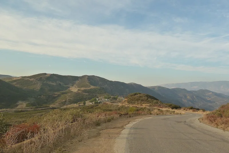

Why it's listed
Winding 17.6 miles over ridges in the Angeles National Forest, the Old Ridge Route is a mountain highway opened in 1915 as one of California's first state highways. It was the first direct automobile and truck link between Los Angeles and the northern part of the state, and by 1919 it was paved with 20-foot-wide reinforced concrete. Engineers avoided canyon routes and instead climbed the ridgelines with banked curves and deep cuts, including the 110-foot Swede's Cut. Traffic grew from 776 vehicles a day in 1920 to 2,280 in 1925, and inns, a road camp and other roadside businesses lined the route. The road was bypassed in 1933 and became a quiet backcountry route. Much of the original concrete, culverts, curbing and right-of-way markers survive, along with ruins of five motor inns and a maintenance camp. Utility lines and pipelines have caused some damage. It was listed for its role in regional transportation and for its engineering.
Significance in brief: It was the first direct automobile and truck route linking Los Angeles with northern California, and it drew heavy traffic, which supported trade, tourism and regional unity. It is also an example of early mountain highway engineering, using sweeping banked curves and deep road cuts such as the 110-foot-deep Swede's Cut.
Machine-generated summary. This summary was generated by a language model from the official nomination document and has not been reviewed line by line by an editor. It may contain errors. Check the source document before relying on any detail. Source: nomination document (PDF) · National Archives catalog entry. NRHP reference 97001113, listed September 25, 1997. Summary generated October 2026 (model claude-sonnet-5-5, prompt v1.0-2026-10-29, confidence high).
Key facts
| Address | Along Old Ridge Rte., roughly bounded by Sandberg and Canton Canyon, Castaic |
|---|---|
| County | Los Angeles County |
| Listed | September 25, 1997 |
| Reference number | 97001113 |
| Resource type | Structure |
| Period of significance | 1915-1933 |
| Architect / builder | W. Lewis Clark and J.B. Woodson, Designers, California Division of Highways; Lee Moor Contracting Company, Builder, El Paso, Texas; Mahoney Brothers, Builder, San Francisco, California |
| Architectural style | Other: Reinforced concrete road |
| Criteria |
|
| Areas of significance | Transportation, Engineering |
| Level of significance | State |
| Status (as stated in the nomination) | Abandoned as a through highway in 1933; the roadway remains open for slow-speed public automobile travel, with sections of potholes and dirt, and most original engineering features in fair to good condition. |
| Acreage | 214 |
| Coordinates | 34.64775, -118.70074 (NPS GIS) |
What listing means for this property
National Register listing is honorary: it recognises significance and does not restrict what a private owner may do without federal money or permits. It unlocks the 20% federal rehabilitation tax credit for income-producing buildings, state credits in many states, and Section 106 review when federal agencies are involved. See what listing means in practice.
General information, not legal or tax advice. Rules change; confirm with your State Historic Preservation Office or a qualified adviser.
Sources and further reading
- National Park Service, National Register of Historic Places database (snapshot May 2026), reference 97001113.
- Nomination form (PDF, National Archives) — catalog entry
- Wikipedia article (used for cross-checking only; text not reproduced here)
- Wikidata Q19195
- This listing as JSON
Last updated October 2026. Found an error? See the editorial policy for how to report it.