Walker Pass

Why it's listed
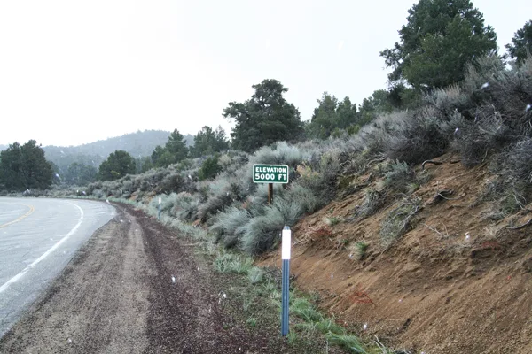
Walker Pass is a natural gap through the southern Sierra Nevada, at 5,246 feet, about 60 miles east-northeast of Bakersfield in Kern County, California. Highway 178 now crosses it. The pass is named for Joseph R. Walker, a fur trapper and guide, and the name was suggested by John C. Fremont in 1844. Walker and his men returned through the pass in 1834 after crossing the Sierra near Yosemite Valley, in what is described as the first known Euro-American passage. In 1843 he led the Chiles emigrant party through it, the first American emigrant party to do so. In 1845 he guided the main body of Fremont's expedition through it. The nomination ties these events to the American exploration and settlement of California. No cultural features from that period survive within the pass, but the setting is described as largely unchanged apart from a highway, trail, signs and a commemorative monument.
Significance in brief: The pass is tied to the explorer Joseph R. Walker, who used it in 1834, 1843 and 1845. His 1834 exit from California was the first known Euro-American passage through the pass. He later guided the Chiles emigrant party (1843) and John C. Fremont's expedition (1845) through it. These events are argued to have contributed to the American exploration and settlement of California.
Machine-generated summary. This summary was generated by a language model from the official nomination document and has not been reviewed line by line by an editor. It may contain errors. Check the source document before relying on any detail. Source: nomination document (PDF) · National Archives catalog entry. NRHP reference 66000210, listed October 15, 1966. Summary generated October 2026 (model claude-sonnet-5-5, prompt v1.0-2026-10-29, confidence medium).
Key facts
| Address | 60 mi. NE of Bakersfield on CA 178, Bakersfield |
|---|---|
| County | Kern County |
| Listed | October 15, 1966 |
| Reference number | 66000210 |
| Resource type | Structure |
| Period of significance | 1834-1845 |
| Criteria |
|
| Areas of significance | Exploration/Settlement |
| Level of significance | National |
| National Historic Landmark | Yes, designated July 4, 1961 |
| Status (as stated in the nomination) | The pass is described as having a high degree of physical and visual integrity, with later additions such as a paved highway, trail, signs and a commemorative monument counted as noncontributing. |
| Acreage | 111.4 |
| Coordinates | 35.66461, -118.02451 (NPS GIS) |
What listing means for this property
National Register listing is honorary: it recognises significance and does not restrict what a private owner may do without federal money or permits. It unlocks the 20% federal rehabilitation tax credit for income-producing buildings, state credits in many states, and Section 106 review when federal agencies are involved. See what listing means in practice.
General information, not legal or tax advice. Rules change; confirm with your State Historic Preservation Office or a qualified adviser.
Sources and further reading
- National Park Service, National Register of Historic Places database (snapshot May 2026), reference 66000210.
- Nomination form (PDF, National Archives) — catalog entry
- Wikipedia article (used for cross-checking only; text not reproduced here)
- Wikidata Q3565409
- This listing as JSON
Last updated October 2026. Found an error? See the editorial policy for how to report it.