Fort Tejon
Also known as: Fort Tejon State Historic Park

Why it's listed
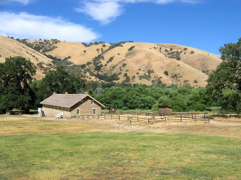
Fort Tejon is a former U.S. Army post in Grapevine Canyon, near Lebec in Kern County, California, on the sloping, oak-shaded ground along old Highway 99. The Army established it on June 24, 1854, to suppress stock rustling and protect Indians in the San Joaquin Valley. As regimental headquarters of the First Dragoons, it became an important military, social and political center. Camels were introduced here for transportation in 1858, and the fort was abandoned on September 11, 1864. It later served as headquarters for the Tejon Ranch until the State acquired it in 1940. Of the twenty or more original adobe and wood-frame buildings, most are ruins. Two barracks and an officers' quarters have been restored, and an orderlies' quarters has been stabilized. The remaining buildings and ruins surround a parade ground of roughly 400 by 400 feet. A park office and orientation center was built in 1958, and a nearby oak commemorates the pioneer Peter Lebec.
Significance in brief: The post was founded in 1854 to suppress stock rustling and protect Indians in the San Joaquin Valley. As regimental headquarters of the First Dragoons, it served as an important military, social and political center. Camels were introduced here for transportation in 1858. The nomination cites significance in military, political, architectural and transportation areas.
Machine-generated summary. This summary was generated by a language model from the official nomination document and has not been reviewed line by line by an editor. It may contain errors. Check the source document before relying on any detail. Source: nomination document (PDF) · National Archives catalog entry. NRHP reference 71000140, listed May 6, 1971. Summary generated October 2026 (model claude-sonnet-5-5, prompt v1.0-2026-10-29, confidence medium).
Key facts
| Address | 3 mi. NW of Lebec, Lebec |
|---|---|
| County | Kern County |
| Listed | May 6, 1971 |
| Reference number | 71000140 |
| Resource type | District |
| Period of significance | June 24, 1854 to September 11, 1864 |
| Areas of significance | Military, Transportation, Politics/Government, Architecture |
| Level of significance | National |
| Status (as stated in the nomination) | Most of the twenty or more original adobe and wood-frame buildings are ruins. Two barracks buildings and an officers' quarters have been restored and maintained, and an orderlies' quarters has been stabilized. Preservation work was in progress, with more restoration planned. |
| Acreage | 205.4 |
| Coordinates | 34.87230, -118.89690 (NPS GIS) |
What listing means for this property
This is a historic district. Buildings within its boundary are either contributing (they add to the district's significance) or non-contributing. Owners of contributing income-producing buildings can claim the 20% federal rehabilitation tax credit; homeowners should look at state credits. National Register districts impose no design review by themselves; a local historic district ordinance, if one exists, does (the difference explained).
General information, not legal or tax advice. Rules change; confirm with your State Historic Preservation Office or a qualified adviser.
Sources and further reading
- National Park Service, National Register of Historic Places database (snapshot May 2026), reference 71000140.
- Nomination form (PDF, National Archives) — catalog entry
- Wikipedia article (used for cross-checking only; text not reproduced here)
- Wikidata Q1415871
- This listing as JSON
Last updated October 2026. Found an error? See the editorial policy for how to report it.