Bandit Rock
Also known as: Robbers Roost

Why it's listed
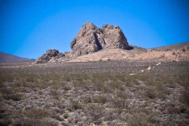
Bandit Rock, also known as Robbers Roost, is a craggy rock outcrop rising to about 4,000 feet west of Freeman Junction near Inyokern in Kern County, California. Visible from Highway 14, it covers roughly five acres and is managed by the Bureau of Land Management. Its height gave a view for miles across the desert, and its crevices and caves offered shelter from harsh weather as well as a place to hide. In 1874 and 1875 it served as the camp and lookout of Tiburcio Vasquez and his gang, who robbed travelers at Coyote Holes, a stage station where the Walker Pass road met the freight road to Los Angeles. Army detachments from Camp Independence pressed the gang, and Vasquez was later captured, tried in San Jose and hanged on March 19, 1875. The outcrop was listed for its link to this chapter of desert lawlessness and remains much as the bandits knew it.
Significance in brief: The rock served as the lookout and hideout of the bandit Tiburcio Vasquez (spelled Tiburico in the form) and his gang in 1874-1875. Vasquez held up travelers at nearby Coyote Holes before his capture and hanging in San Jose in 1875. The nomination calls it a historic and scenic landmark tied to lawlessness in the California desert.
Machine-generated summary. This summary was generated by a language model from the official nomination document and has not been reviewed line by line by an editor. It may contain errors. Check the source document before relying on any detail. Source: nomination document (PDF) · National Archives catalog entry. NRHP reference 75000431, listed October 31, 1975. Summary generated October 2026 (model claude-sonnet-5-5, prompt v1.0-2026-10-29, confidence medium).
Key facts
| Address | SW of Inyokern near jct. of CA 14 and 178, Inyokern |
|---|---|
| County | Kern County |
| Listed | October 31, 1975 |
| Reference number | 75000431 |
| Resource type | Site |
| Period of significance | 1874-1875 |
| Areas of significance | Social History |
| Level of significance | Local |
| Status (as stated in the nomination) | Described as in good condition, unaltered and on its original site, remaining much as it was when Vasquez used it; the form marks it as unoccupied, with unrestricted public access. |
| Acreage | 5 |
| Coordinates | 35.59106, -117.94980 (NPS GIS) |
What listing means for this property
Sites (archaeological sites, battlefields, landscapes) are often listed with a restricted address to protect them from looting or disturbance. Listing is honorary for private owners; federal undertakings on or near the site go through Section 106 review, and state laws may protect burials and artefacts regardless of listing.
General information, not legal or tax advice. Rules change; confirm with your State Historic Preservation Office or a qualified adviser.
Sources and further reading
- National Park Service, National Register of Historic Places database (snapshot May 2026), reference 75000431.
- Nomination form (PDF, National Archives) — catalog entry
- Wikipedia article (used for cross-checking only; text not reproduced here)
- Wikidata Q7340817
- This listing as JSON
Last updated October 2026. Found an error? See the editorial policy for how to report it.