Radar Station B-71
Also known as: Klamath Ranger Station; Trinidad Radar Station; Klamath River

Why it's listed
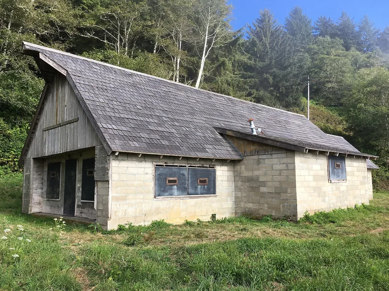
Radar Station B-71, also called the Klamath River or Trinidad station, was an Army aircraft early warning post on a coastal shelf about 250 feet above the Pacific, two miles south of the Klamath River mouth. Built in late 1942 and early 1943, it was the northernmost California station in a Pacific Coast network of 65 stations actually built. Two thick concrete block buildings were designed to look like farm structures: a power building made to resemble a farmhouse, with false dormers and windows, and an operations building disguised as a barn. The form notes that building camouflage into new construction was unusual. A crew of about 35 men worked in shifts, and three machine guns protected the site. Converted to air-sea rescue service in July 1944, it stayed operational until the war's end, then reverted to ranch use. Decay, salvage, vandalism and mud slides have damaged it, yet it survives as a rare example of early American radar defenses.
Significance in brief: The station is described as having regional architectural and military historical significance as a rare survivor of a World War II early warning radar station. Its buildings were designed with built-in camouflage, a farmhouse and a barn, which the form calls unusual. It was part of the pioneering radar air defense network on the Pacific Coast, and most of its sister stations have disappeared.
Machine-generated summary. This summary was generated by a language model from the official nomination document and has not been reviewed line by line by an editor. It may contain errors. Check the source document before relying on any detail. Source: nomination document (PDF) · National Archives catalog entry. NRHP reference 78000282, listed April 19, 1978. Summary generated October 2026 (model claude-sonnet-5-5, prompt v1.0-2026-10-29, confidence medium).
Key facts
| Address | W of Klamath, Klamath |
|---|---|
| County | Del Norte County |
| Listed | April 19, 1978 |
| Reference number | 78000282 |
| Resource type | Building |
| Period of significance | 1942 |
| Architect / builder | Built for the Army by a private construction firm under Army contract (firm not named) |
| Areas of significance | Military, Architecture |
| Level of significance | State |
| Status (as stated in the nomination) | Marked unoccupied. The buildings have decayed through vandalism, salvage and mud slides, and the privy is a partially collapsed ruin, but enough significant elements survive. |
| Acreage | 18.2 |
| Coordinates | 41.52192, -124.08045 (NPS GIS) |
What listing means for this property
For an income-producing building, listing (individually or as a contributing building in a district) is the gateway to the 20% federal rehabilitation tax credit on qualified rehabilitation costs, often stackable with state credits. Work claiming the credit must follow the Secretary of the Interior's Standards and be approved in advance.
Listing does not restrict a private owner acting without federal money or permits; where federal funding or licensing is involved, Section 106 review applies.
Noted as vacant in the nomination. Nomination documents can be decades old; current status may differ. If you are considering buying an empty listed property, read the due-diligence checklist.
General information, not legal or tax advice. Rules change; confirm with your State Historic Preservation Office or a qualified adviser.
Sources and further reading
- National Park Service, National Register of Historic Places database (snapshot May 2026), reference 78000282.
- Nomination form (PDF, National Archives) — catalog entry
- Wikipedia article (used for cross-checking only; text not reproduced here)
- Wikidata Q7279981
- This listing as JSON
Last updated October 2026. Found an error? See the editorial policy for how to report it.