Black Diamond Mines
Also known as: Black Diamond Mines Regional Preserve
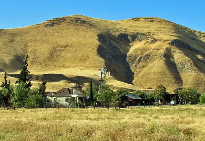

Why it's listed
Black Diamond Mines is a 2,078-acre district in central Contra Costa County, California, where coal was prospected in the mid-1850s. Five towns grew around the pitheads, including Nortonville and Somersville, and the coal boom lasted into the early 1900s, when the last mines closed and the towns were abandoned. High-silica sand was mined here from about 1925 to 1951. Recorded remains number 272 features, including building platforms, cellar holes, a cemetery, large coal tailings piles, brick hoisting footings, sealed adits and vents. Underground workings are estimated at 200 miles of passages and over 1,200 acres of mined-out rooms. The district is significant for its link to California's most important coal mining, for the best array of coal mining features and the state's only surviving room-and-pillar sand mine, and for its potential to inform on Welsh immigrants. It is now a regional preserve used for recreation.
Significance in brief: The nomination argues the district is associated with the state's most important coal mining operations (criterion A). It holds an impressive array of coal mining features and the only surviving example of room and pillar sand mining in California (criterion C). It may also yield information on the history and assimilation of Welsh people in California (criterion D).
Machine-generated summary. This summary was generated by a language model from the official nomination document and has not been reviewed line by line by an editor. It may contain errors. Check the source document before relying on any detail. Source: nomination document (PDF) · National Archives catalog entry. NRHP reference 91001425, listed October 2, 1991. Summary generated October 2026 (model claude-sonnet-5-5, prompt v1.0-2026-10-29, confidence medium).
Key facts
| Address | Somersville Rd. SE of Antioch, Antioch |
|---|---|
| County | Contra Costa County |
| Listed | October 2, 1991 |
| Reference number | 91001425 |
| Resource type | District |
| Period of significance | 1859-1907 and circa 1910-1941 |
| Criteria |
|
| Areas of significance | Industry, Historic - Non-Aboriginal, Engineering, European, Social History |
| Level of significance | State |
| Status (as stated in the nomination) | Now used for outdoor recreation as Black Diamond Mines Regional Preserve; many mine openings have been sealed or reconstructed, and the townsites are deserted. |
| Acreage | 2078 |
| Coordinates | 37.95683, -121.85014 (NPS GIS) |
What listing means for this property
This is a historic district. Buildings within its boundary are either contributing (they add to the district's significance) or non-contributing. Owners of contributing income-producing buildings can claim the 20% federal rehabilitation tax credit; homeowners should look at state credits. National Register districts impose no design review by themselves; a local historic district ordinance, if one exists, does (the difference explained).
General information, not legal or tax advice. Rules change; confirm with your State Historic Preservation Office or a qualified adviser.
Sources and further reading
- National Park Service, National Register of Historic Places database (snapshot May 2026), reference 91001425.
- Nomination form (PDF, National Archives) — catalog entry
- Wikipedia article (used for cross-checking only; text not reproduced here)
- Wikidata Q4920660
- This listing as JSON
Last updated October 2026. Found an error? See the editorial policy for how to report it.